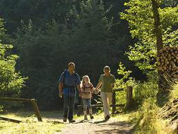
Kefermarkter Rundweg
Path number: N6
Starting place: 4212 Neumarkt im Mühlkreis
Destination: 4212 Neumarkt im Mühlkreis
Via the Way of the Cross to Kefermarkt
Via the Way of the Cross, the hiking trail runs past the Reihalle and the riding paddocks of the Stroblmair family's "Prandstetter" estate to the Dietscher pond. Via Wagrein it goes down to Kefermarkt. During the descent, Weinberg Castle and the Feldaisttal valley form a magnificent backdrop.After crossing the Lester stream, you reach the Dörfl settlement. Passing the sports field and outdoor pool, you head up to the village center. You should not only pay a visit to the parish church with its world-famous winged altar. Weinberg Castle, host of the 1988 state exhibition, is also a must. The route back to Neumarkt is somewhat arduous as it is mostly uphill.
Once you have finally climbed the Tannberg, you are rewarded with a magnificent view. When the weather is fine, the Lower Austrian and Upper Austrian mountain ranges spread out before you.
A short path downhill finally leads back to the market square
Path number: N6
Starting place: 4212 Neumarkt im Mühlkreis
Destination: 4212 Neumarkt im Mühlkreis
duration: 3h 30m
length: 13,0 km
difficulty: difficult
condition: medium
panoramic view: Great panorama
Paths covering:
Hiking trail
Starting point: Marketplace
Destination: Marketplace
further information:
- Flatly
- Possible accommodation
Accessibility / arrival
by car:
On the A1 motorway to Linz, from there continue on the A 7 (Mühlkreisautobahn) to Unterweitersdorf. From there on the B 310 to Neumarkt.
By train:
By train to Linz - from Linz there are many post buses to Neumarkt.
- All weather
- Suitable for groups
- Suitable for schools
- Pets allowed
- Spring
- Summer
- Autumn
Please get in touch for more information.
Marktplatz 1
4212 Neumarkt im Mühlkreis
Phone +43 7941 8255
E-Mail gemeinde@neumarkt-muehlkreis.ooe.gv.at
Web www.neumarkt-muehlkreis.ooe.gv.at
Web www.muehlviertel-urlaub.at/wandern
http://www.neumarkt-muehlkreis.ooe.gv.at
http://www.muehlviertel-urlaub.at/wandern
http://www.muehlviertel-urlaub.at/wandern


