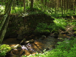
Seufzer Allee
Starting place: 4132 Lembach im Mühlkreis
Destination: 4132 Lembach im Mühlkreis

Beautiful, romantic and easy destination hike
This very beautiful, relaxing and romantic hike begins at the market square in Lembach.The hike leads past the old people's home to the Devil's Stone, which is located on the left-hand side of the path.
According to legend, a farmer once promised the devil his soul here if the devil gave him money. But one day the farmer regretted this deal, went to the stone, threw the money back at Satan's feet and said a prayer. Out of anger, the devil plunged his fork into the stone, the traces of which can allegedly still be seen today.
From here, the trail leads downhill through the forest (Seufzer-Allee) to the Gasthof Bruckwirt, which invites you to stop for a bite to eat. The way back is identical to the way there.
Starting place: 4132 Lembach im Mühlkreis
Destination: 4132 Lembach im Mühlkreis
duration: 1h 9m
length: 4,2 km
Altitude difference (uphill): 32m
Altitude difference (downhill): 184m
Lowest point: 396m
Highest point: 550m
difficulty: easy
condition: easy
panoramic view: No view
Paths covering:
Gravel
Starting point: Marketplace Lembach
Destination: Marketplace Lembach
further information:
- Board possible
Accessibility / arrival
Car: from Linz on the B127 approx. 33 km to the Altenfelden roundabout, 3rd turn-off to Lembach, follow the road for approx. 6 km, turn left to the centre of Lembach
Bus: from Linz with public buses from the main railway station in approx.
Bus timetable to Lembach available on the Website of the market town of Lembach.
Train: Take the Mühlkreisbahn to Neufelden station - approx. 10 km away - by taxi Altendorfer 07286/8508 to Lembach
Nearest airport: Linz/Hörsching
Barge: to Obermühl an der Donau - approx. 6 km away - by taxi Altendorfer 07286/8508 to Lembach
- Suitable for groups
- Suitable for schools
- Suitable for kids (all ages)
- Suitable for teenagers
- Suitable for single travelers
- Suitable for families
- Suitable for friends
- Suitable for couples
- Suitable for children
- Spring
- Summer
- Autumn
Please get in touch for more information.
4132 Lembach im Mühlkreis
Phone +43 7286 8255 - 0
Fax machine +43 7286 8255 - 34
E-Mail info@lembach.ooe.gv.at
Web www.gemeinde-lembach.at
http://www.gemeinde-lembach.at


