© Photo: Oberösterreich Tourismus GmbH./Robert Maybach: Enjoy the view in Upper Austria
Enjoy the view in Upper Austria
Search
Search
Close

381 Cycle tour "Auf's Weiss´n"

  • culinary interesting
  • Flatly

 Interactive elevation profile

Download GPS data
Create PDF

Tour-Details

Path number: 381
Starting place: 4540 Bad Hall
Destination: 4540 Bad Hall

duration: 2h 0m
length: 34,0 km
Altitude difference (uphill): 650m

difficulty: difficult
condition: difficult
panoramic view: Great panorama

Paths covering:
Asphalt

powered by TOURDATA

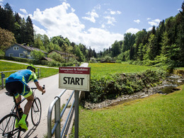
Scenic warm-up tour including performance test on the Weiss'n standard route; tour corresponds to No. 10 of the Bad Hall cycle routes and is signposted throughout.

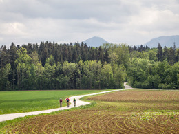
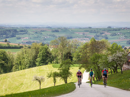
The short tour via one of the most beautiful vantage points in our region combines training (warm-up and roll-in option via Feyregg) and nature experience (views of the Kremstal and the foothills of the Alps at Krühub) right at the start. On the first flat, then sloping district road to the Nußbach sports centre, the pace picks up noticeably. The following 3.9 km long mountain classification allows those interested to evaluate wattage data (stopwatch required) - more information is available at the sports centre; alternatively, the 763 m high Weiss'n can be conquered at any speed and the varied route and magnificent views of the Tote Gebirge and Mühlviertel can be admired. At the viewing platform, a satisfied look, performance evaluation and/or a refreshment stop are the order of the day. The descent is brisk and winding via Sattel and Thürschelm to Nußbach, and then quiet on moderately hilly goods roads.


Our lovely blogger Angelika Mandler-Saul has written a wonderful report about our cycling region, which you can read here!
Travelling by public transport
Route planner for independent travellers
  • Suitable for groups
Most economical season
  • Spring
  • Summer
  • Autumn

Please get in touch for more information.


381 Cycle tour "Auf's Weiss´n"
Tourismusverband Bad Hall
Kurpromenade 1
4540 Bad Hall

Phone +43 7258 7200
Fax machine +43 7258 7200 - 20
E-Mail info@badhall.at
Web www.badhall.at
http://www.badhall.at

We speak the following languages

German

 Interactive elevation profile

Download GPS data
Create PDF

Tour-Details

Path number: 381
Starting place: 4540 Bad Hall
Destination: 4540 Bad Hall

duration: 2h 0m
length: 34,0 km
Altitude difference (uphill): 650m

difficulty: difficult
condition: difficult
panoramic view: Great panorama

Paths covering:
Asphalt

powered by TOURDATA