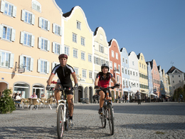
Pramtal Bike Path R21
Path number: R21
Starting place: 4755 Zell an der Pram
Destination: 4780 Schärding
Total distance: Zell an der Pram to Schärding 30 km
The main attractions are the numerous museums and heritage centres along the Pramtal Museum Route. Via Andorf and Taufkirchen, you finally reach the enchanting baroque jewel of Schärding. Here you can continue the tour on the Inn Cycle Path.
Tips:
17 interesting museums can be found along this route.
This tour leads directly past the following culinary partner:
Path number: R21
Starting place: 4755 Zell an der Pram
Destination: 4780 Schärding
duration: 2h 0m
length: 30,8 km
Altitude difference (uphill): 179m
Lowest point: 302m
Highest point: 368m
difficulty: medium
condition: medium
panoramic view: Some Views
Paths covering:
Asphalt, Gravel
Starting point: Zell an der Pram, Aschachtal Bike Path
Destination: Inn Bike Path in Schärding
further information:
- culinary interesting
- Possible accommodation
Accessibility / arrival
The starting point for the bike path can be chosen freely.
Downtown Schärdinger = short-term parking zone with obligatory parking fees of € 2.20 for 2 hours Free car parks = cemetery car park or near the Alte Innbrücke aon the German side in Neuhaus Schärdinger Parkhaus (parking garage)
- Suitable for teenagers
- Suitable for seniors
- Suitable for single travelers
- Suitable for families
- Suitable for friends
- Suitable for couples
- Spring
- Summer
- Autumn
Please get in touch for more information.
Innbruckstraße 29
4780 Schärding
Phone +43 7712 4300 - 0
Fax machine +43 7712 4320
E-Mail info@schaerding.info
Web www.schaerding.at
http://www.schaerding.at


