Prandegg Nr. 81
Starting place: 4274 Schönau im Mühlkreis
Destination: 4274 Schönau im Mühlkreis
Schulstraße 1
4274 Schönau im Mühlkreis
4274 Schönau im Mühlkreis

The longest, but probably also the most interesting hiking trail leads from the centre of Schönau via the "Stoaninger Alm" with a rest stop, speed gliding track and the Herrgottsitz.
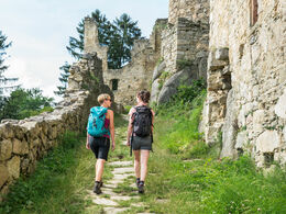
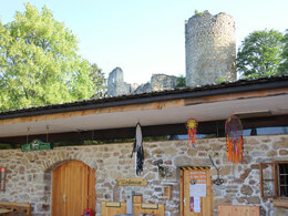
From there, the trail continues via Kollnedt to Prandegg, the second largest castle ruin in Upper Austria. After a visit to the ruins and a break in the tavern, you return to Schönau on the well-signposted hiking trail through the rural cultural landscape.
This hiking trail is also signposted from the village of Oberndorf. If the hiker chooses the starting point of Oberndorf, the walking time is around 2.5 hours.
Starting place: 4274 Schönau im Mühlkreis
Destination: 4274 Schönau im Mühlkreis
duration: 3h 24m
length: 14,0 km
Altitude difference (uphill): 433m
Altitude difference (downhill): 408m
Lowest point: 638m
Highest point: 845m
difficulty: medium
condition: medium
panoramic view: Great panorama
Paths covering:
Asphalt, Gravel, Hiking trail
Starting point: at the village square by the bus stop
Destination: at the village square by the bus stop
further information:
- Flatly
- Board possible
Information at the municipal office
Accessibility / arrival
by car:
Exit Linz, continue on Mühlkreis-Autobahn/A7/E55 - leave Mühlkreis-Autobahn/A7/E55 - continue in the direction of Pregarten/Bad Zell - enter Bad Zell - continue on Linzer Straße/B124 - turn left in Bad Zell
Follow direction: Unterweißenbach/Liebenau/Schönau
- Suitable for kids (6 - 10 Year)
- Suitable for families
- Summer
- Autumn
Please get in touch for more information.
Schulstraße 1
4274 Schönau im Mühlkreis
Phone +43 7261 7255
E-Mail gemeinde@schoenau-im.at
Web www.schoenau-im.at
http://www.schoenau-im.at


