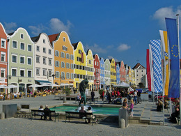
Reichersberg - Schärding Variant 2 (East)
Starting place: 4981 Reichersberg
Destination: 4780 Schärding
Reichersberg - Suben (14 km)
From Reichersberg you follow the Inn cycle path (R3) in the direction of Suben. Shortly before Suben, the "1000 years old lime tree" inn invites you to take a break.
Suben - St. Florian am Inn (5 km)
Pass the prisoner house and follow the road (1 km). Immediately after the former Schnelldorf inn, turn left again onto the cycle path towards St. Florian am Inn.
St. Florian am Inn - Schärding (3 km)
After the church, take the sidewalk and bike path to the end of St. Florian am Inn. Cross the main road and turn left down into Grüntal, continue through Eichbüchl and raod Kurhausstraße into Innbruck road. Turn left here and you will arrive directly at the bicycle and guest service Alte Innbrücke.
TIP: At this information point you will also be offered a bike service station and competent advice around your cycling vacation.
- Suitable for groups
- Suitable for teenagers
- Suitable for single travelers
- Suitable for families
- Suitable for friends
- Spring
- Summer
- Autumn
- Early winter
Please get in touch for more information.
4981 Reichersberg
Phone +43 7723 8555
Fax machine +43 7723 8555 - 4
E-Mail gemeinde@reichersberg.ooe.gv.at
Web www.reichersberg.at
Web www.innviertel-tourismus.at
http://www.reichersberg.at
https://www.innviertel-tourismus.at
https://www.innviertel-tourismus.at


