Töpferwanderweg
4262 Leopoldschlag

Leopoldschlag, the northernmost municipality in the Freistadt region, is characterised by deceleration and an unadulterated experience of nature.
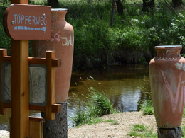
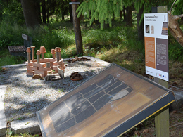
Allow yourself about 2 hours and follow in the footsteps of the potters of the past and experience the work of a potter during the course of the pottery year at the 7 illustrative stations. You can barbecue, paint and make pottery along the way.
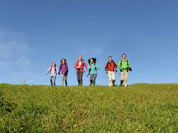
The pottery trail runs on flat terrain and is therefore particularly popular with families with children. The trail starts at the market square and after approx. 100 metres leads along the Maltsch river in the Natura 2000 European nature reserve. After a while, you reach the pottery site at the clay pit in Gerichtsholz. Continue to the Hafnerhaus. There you will find a museum where pottery courses are also offered. From the Hafnerhaus you are back at the starting point on the market square in just a few minutes
Paths covering:
further information:
- Flatly
- Board possible
Details - hiking
- themed path
daily
by car:
from Linz: via the A7 motorway to Unterweitersdorf, continue on the S10 towards Freistadt, exit Freistadt Nord, continue on the B310 to Leopoldschlag
by train:
from Linz: Summerauerbahn to Summerau station --> 10 km to Leopoldschlag
- Suitable for groups
- Suitable for schools
- Suitable for pushchairs
- Suitable for teenagers
- Suitable for seniors
- Suitable for single travelers
- Suitable for families
- Suitable for friends
- Suitable for couples
- Suitable for children
The entire hiking trail and the individual stations are completely barrier-free and wheelchair-accessible.
Most economical season- Spring
- Summer
- Autumn
- Early winter
Somewhat suitable for wheelchairs: Assistance is sometimes necessary. The measurements do not (fully) conform to the legally stipulated ÖNORM.
The existing path may not be completely barrier-free due to heavy rainfall. It may be possible to use goods roads in some places.
The stations have been designed so that the descriptions are easy to read even at sitting height. Due to the proximity to the Czech neighbours, the signage was prepared bilingually in German and Czech.
The activity stations can also be used while seated. The rest and recreation areas are equipped with flexible benches so that wheelchair users can also sit at the table!
Marktplatz 17
4262 Leopoldschlag
Phone +43 7949 8255
E-Mail gemeinde@leopoldschlag.ooe.gv.at
Web www.leopoldschlag.ooe.gv.at/
Web www.muehlviertel-urlaub.at/wandern
http://www.muehlviertel-urlaub.at/wandern


