Penzenstein-Wanderung
Path number: 16 - Wanderweg
Starting place: 4090 Engelhartszell
Destination: 4090 Engelhartszell
Marktplatz 61
4090 Engelhartszell
4090 Engelhartszell

This hiking trail has the trail number 16.
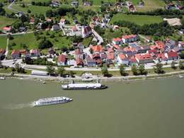
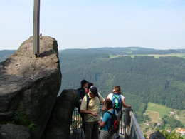
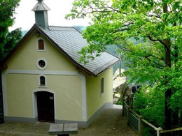
The starting point is the Danube ferry in Engelhartszell. Cross over and walk approx. 300 metres down the Danube to the start of trail 679, the "Pühretsteig". The trail climbs through a beech forest to Pühret and continues on hiking trail 677, the "Öttlsteig" to the Penzenstein, a rocky outcrop 568 metres high with a view of the Danube valley and Engelhartszell. An iron cross adorns the granite blocks and the chapel, built in 1790, nestles against the rocks.Legend has it that "Seppenhans" from Kramesau rescued a statue of "St Nepomuk" from the flood. When a wooden chapel was built on the Penzenstein, he placed his Nepomuk there, but this resulted in terrible misfortune for the Kramesau. He brought the statue home, but it continued to haunt the neighbouring villages. A farmer from Großmollsberg decided to put an end to the haunting and built a new chapel on the Penzenstein. Only then did peace return.
The trail continues to the left along the edge of the forest, where after a short while you reach the start of the "Frauensteig". It ends opposite Engelhartszell at the ferry.
- Suitable for kids (6 - 10 Year)
- Suitable for single travelers
- Suitable for families
- Suitable for friends
- Suitable for couples
- Spring
- Summer
- Autumn
Please get in touch for more information.
Marktplatz 61
4090 Engelhartszell
Phone +43 7717 8055 - 16
E-Mail tourismus@engelhartszell.ooe.gv.at
Web www.engelhartszell.at
https://www.engelhartszell.at


