Kapellen-Wanderung
Path number: 11 - Wanderweg
Starting place: 4090 Engelhartszell
Destination: 4090 Engelhartszell
Marktplatz 61
4090 Engelhartszell
4090 Engelhartszell

This hiking trail has the trail number 11.
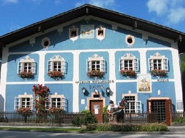
From the Engelhartszell market town hall, the path leads to the 400-year-old Maislinger family farrier's museum. Tel. +43(0)7717/8059At the "Golden Ship", use the road subway and walk along the Danube to Oberranna. After crossing the road, the hiking trail leads left past the "Magna Marta Austriae" chapel.
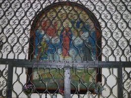
Uphill past the "Hochwurzel" farm to the plateau. There, a meadow path on the left leads to St Pankraz Chapel. It is home to a spring that was once said to have healing properties.
The hiking trail markings lead to Schauern, where you pass the "Burgblick" on the Sauwald panoramic road. Continue to St. Aegidi and on the road towards Engelhartszell. Shortly after the bridge over the rushing stream, the path turns right towards Engelhartszell.
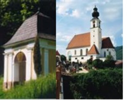
The Gothic-style market church is well worth a visit. Gravestones on the outer walls bear witness to the importance of the market.
- Suitable for groups
- Suitable for schools
- Suitable for kids (10 - 14 Year)
- Suitable for single travelers
- Suitable for families
- Suitable for friends
- Suitable for couples
- Spring
- Summer
- Autumn
Please get in touch for more information.
Marktplatz 61
4090 Engelhartszell
Phone +43 7717 8055 - 16
E-Mail tourismus@engelhartszell.ooe.gv.at
Web www.engelhartszell.at
https://www.engelhartszell.at


