Forellen-Wanderung
Path number: 3 - Wanderweg
Starting place: 4090 Engelhartszell
Destination: 4090 Engelhartszell
Marktplatz 61
4090 Engelhartszell
4090 Engelhartszell

This hiking trail has the trail number 3.
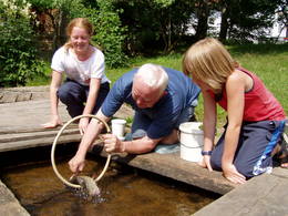
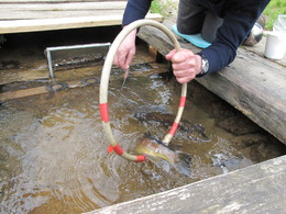
From the Engelhartszell municipal office, the trail leads past the market church, uphill along the road until it enters the forest on the left after approx. 500 metres. The trail leads uphill through a spruce forest with beautiful views of the Danube to the "Lugmühle", the sawmill at the sausenden Bauch. The trail follows the road to Stadl as far as Mühlbach, where a sign indicates the "Forellenzirkus" (trout circus) on the left. In addition to the tricks of the jumping trout and the tame rooster, there is much to discover in the mill museum.Tel. +43/0)7717/7552
The route continues uphill past the farmhouses of Schöberg and Edt until you reach the hilltop village of Stadl with its neo-Gothic church. From here, follow the road towards Engelhartszell. After the villages of Kicking and Vierling, turn left at the crossroads and after approx. 100 metres turn right again onto a farm track. The path leads downhill through a mixed forest back to Engelhartszell.
Path number: 3 - Wanderweg
Starting place: 4090 Engelhartszell
Destination: 4090 Engelhartszell
duration: 4h 19m
length: 13,8 km
Altitude difference (uphill): 454m
Altitude difference (downhill): 447m
Lowest point: 287m
Highest point: 724m
difficulty: easy
condition: easy
panoramic view: Dreamtour
Paths covering:
Asphalt, Gravel, Hiking trail
further information:
- Flatly
Details - hiking
- themed path
Parking
- Parking space: 10
- Charging point for electric cars (fees apply)
- Charging point for e-bikes (free of charge)
Payment methods
Cash payment
- Suitable for schools
- Suitable for teenagers
- Suitable for seniors
- Suitable for single travelers
- Suitable for families
- Suitable for friends
- Suitable for couples
- Spring
- Summer
- Autumn
Please get in touch for more information.
Marktplatz 61
4090 Engelhartszell
Phone +43 7717 8055 - 16
E-Mail tourismus@engelhartszell.ooe.gv.at
Web www.engelhartszell.at
Web www.donauregion.at/engelhartszell.h…
https://www.engelhartszell.at
https://www.donauregion.at/engelhartszell.html
https://www.donauregion.at/engelhartszell.html


