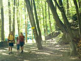
Hochweg - Forest Path
Starting place: 4682 Geboltskirchen
Destination: 4682 Geboltskirchen
Feld 10
4682 Geboltskirchen
4682 Geboltskirchen

The shortest way leads from the parking lot on the plateau (Eberschwanger Straße) in the direction of Wolfsegg on the Hochweg, the 810 Path (Ruperti-Weg) over the first steep rise, past the "Stone Table" and the image of the Virgin Mary of the "Dreiherrenspitz" into a dip. After another 10 minutes you can see the ski lift of the Eberschwang ski area on the right side. A signpost "Zum Aussichtsbankerl" points to the right, where after about 150 m on a small hill, the Ledererwirtsköpfl with 750 m, the "Bankerl" is waiting.
Free hiking map available at the Tourist-Infos Bad Schallerbach and Gallspach.
Free hiking map available at the Tourist-Infos Bad Schallerbach and Gallspach.
Accessibility / arrival
By car:
Freeway:
On the A8 coming from Passau, exit Haag am Hausruck --> approx. 10 km to Geboltskirchen.
On the A8 coming from Linz, exit Haag am Hausruck --> approx. 10 km to Geboltskirchen
Federal road:
Coming from Ried im Innkreis or Grieskirchen on the B 141
by train:
Get off at the train station Haag am Hausruck --> approx. 4 km to Geboltskirchen
- Free entry
Most economical season
- Spring
- Summer
- Autumn
Please get in touch for more information.
Feld 10
4682 Geboltskirchen
Phone +43 7732 3513
Fax machine +43 7732 351314
E-Mail office@geboltskirchen.at
Web www.geboltskirchen.at/
http://www.geboltskirchen.at/


