© Photo: Oberösterreich Tourismus GmbH./Robert Maybach: Enjoy the view in Upper Austria
Enjoy the view in Upper Austria
search
Search
Close

AUFWÄRMRUNDE

  • All weather
  • Suitable for families
  • Flatly

 Interactive elevation profile

Download GPS data
Create PDF

Tour-Details

Starting place: 4910 Ried im Innkreis
Destination: 4910 Ried im Innkreis

duration: 0h 15m
length: 1,8 km
Altitude difference (uphill): 20m
Altitude difference (downhill): 21m

Lowest point: 412m
Highest point: 438m
difficulty: very easy
condition: very easy
panoramic view: Individual Views

Paths covering:
Asphalt, Hiking trail

powered by TOURDATA

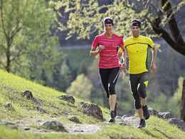
In an unspoiled natural landscape, the warm-up loop is the ideal route for beginners and those in a hurry. On almost flat forest and gravel paths ideal for runners or walkers, the route leads through the Ried forest and back to the starting point.
Travelling by public transport
Route planner for independent travellers
  • All weather
  • Suitable for groups
  • Suitable for schools
  • Suitable for teenagers
  • Suitable for seniors
  • Suitable for single travelers
  • Suitable for families
  • Suitable for friends
  • Suitable for couples
  • Suitable for children
Most economical season
  • Spring
  • Summer
  • Autumn
  • Early winter
  • Deep winter

Please get in touch for more information.


AUFWÄRMRUNDE
Stadtamt Ried
4910 Ried im Innkreis

Phone +43 7752 901
E-Mail office@ried.gv.at
Web www.innviertel-tourismus.at/sinnvie…
Web www.ried.at
https://www.innviertel-tourismus.at/sinnviertel-erleben/sport-freizeit/wandern/wanderwege.html
http://www.ried.at

You can also visit us on

Visit us on Facebook

We speak the following languages

German

 Interactive elevation profile

Download GPS data
Create PDF

Tour-Details

Starting place: 4910 Ried im Innkreis
Destination: 4910 Ried im Innkreis

duration: 0h 15m
length: 1,8 km
Altitude difference (uphill): 20m
Altitude difference (downhill): 21m

Lowest point: 412m
Highest point: 438m
difficulty: very easy
condition: very easy
panoramic view: Individual Views

Paths covering:
Asphalt, Hiking trail

powered by TOURDATA