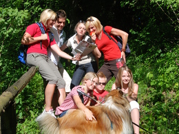
Weg Nr. 5 "Lindetwald - Weg"
Starting place: 4780 Schärding
Destination: 4780 Schärding
The leisurely circular walk starts at the boat landing stage and takes you along the long-distance hiking trail 810A (10) up the Inn to the Inn bridge with its 11 pillars, and past the Kneipp spa centre we reach the area of St. Florian am Inn on a footpath.
As our route runs along the dam path between the Inn and the so-called "Sporn", it does not touch the village of St. Florian on the high bank directly, but bypasses the penultimate Inn barrage in the village of Badhöring and follows the tarmac Inn cycle path R3 to Schnelldorf on the high bank. Here you cross the Subener Bundesstraße and later the railway line, heading towards the Lindetwald forest via goods and field paths. After the Schärding - Suben border airfield, we branch off onto hiking trail no. 5 at a crossroads. You walk past the water basin and up to the burial mounds. The trail then leads you in a north-westerly direction along a forest path slightly downhill to a forest road. Continue to the right, past the Pröbstl composting plant, to Roßbach via the railway (Schärding - Suben) to Schnelldorf. The loop closes and you return to the starting point on the familiar route accompanied by the River Inn. Parking
- Parking space: 30
Payment methods
Cash payment
- Suitable for groups
- Suitable for schools
- Suitable for kids (3 - 14 Year)
- Pets allowed
- Suitable for single travelers
- Suitable for families
- Suitable for friends
- Suitable for couples
- Suitable for children
- Spring
- Summer
- Autumn
Please get in touch for more information.
Innbruckstraße 29
4780 Schärding
Phone +43 7712 4300 - 0
Fax machine +43 7712 4320
E-Mail info@schaerding.info
Web www.schaerding.at
http://www.schaerding.at


