Schermberg im Toten Gebirge
Starting place: 4645 Grünau im Almtal
Destination: 4645 Grünau im Almtal
Tough one-day or more leisurely two-day tour to the third highest peak in the Totes Gebirge.
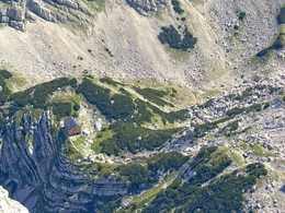
The Schermberg was once regarded as a shelter and umbrella over the valley. "I'm not a fantasist, I don't sigh at every waterfall and I don't get excited at every rock face and every snowfield," Sepp Huber once wrote about the Schermberg, "but here nature seems overwhelming." This is no exaggeration: its north face is 1,400 metres high and 2 km wide - putting it on a par with the north face of the Triglav or the east face of the Watzmann. And yet the stone giant is relatively easy to climb: From the Almtaler Haus, hike southwards on the forest road marked 215 to Hintere Hetzau, where the valley station of the material cable car is located. Now follow a path over a stream bed and diagonally to the rock step of the foundation walls, which is climbed in hairpin bends (steel cables). Through the forest slope, later through scree to another wall, which you climb on a ladder. Then head left along a rocky ledge and up a steep slope - under the material cable car - to the Welser Hütte. Continue on trail no. 215, which soon leads via a staircase to the ponds (spring). Past large boulders into a cirque (slabs, often snowfield) and left on the rope-secured Hansbauernband over a rock step. Now through the debris-filled Fleischbank cirque to the Fleischbank saddle on the edge of the high plateau, where trail no. 262 joins. Turn right here and - gently descending - over rock slabs and scree at the foot of the Sauzahn to the junction of paths no. 215 and no. 263 below the Schermberg (shelter cave). Turn right, through the stepped rocky slope onto the Pfaffenschneid and up this to the right to the unusually shaped summit sign on the top of the Schermberg. On the descent, we briefly walk back along the ridge, but then turn left following marker no. 263 and reach the cirque between the Almtaler Köpfl and the Sauzahn via a rock and scree slope. At the bottom you reach the ascent path again, on which you return to the left to the Welser Hütte and the Almtaler Haus.The paths are very steep, exposed and secured in places. On the plateau, orientation becomes very difficult in foggy or snowy conditions.
Rest stops:
Almtaler Haus, Welser Hütte
Parking
- Parking space: 20
Most economical season
- Spring
- Summer
- Autumn
Please get in touch for more information.
Im Dorf 17
4645 Grünau im Almtal
Phone +43 7616 8268
E-Mail almtal@traunsee-almtal.at
Web www.traunsee-almtal.at
Web www.welserhuette-gruenau.com/
https://www.traunsee-almtal.at
https://www.welserhuette-gruenau.com/
https://www.welserhuette-gruenau.com/


