R6 connection Rainbach - Freistadt
Path number: R6
Starting place: 4261 Rainbach im Mühlkreis
Destination: 4261 Rainbach im Mühlkreis
Prager Straße 5
4261 Rainbach im Mühlkreis
4261 Rainbach im Mühlkreis

The Rainbach-Freistadt R6 connecting path starts at the market square in Rainbach.
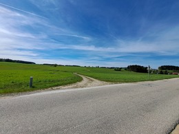
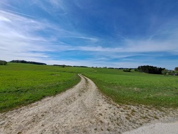
After leaving the residential area, you come to the village of Apfoltern. In the direction of Labach you reach a beautiful wide meadow hiking trail. After passing the village of Sonnberg, you reach the Freistadt Medieval Hiking Trail. Where you can choose which route you want to take to Freistadt.
Path number: R6
Starting place: 4261 Rainbach im Mühlkreis
Destination: 4261 Rainbach im Mühlkreis
duration: 1h 40m
length: 6,6 km
Altitude difference (uphill): 42m
Altitude difference (downhill): 63m
Lowest point: 675m
Highest point: 710m
difficulty: easy
condition: easy
panoramic view: Individual Views
Paths covering:
Asphalt, Gravel, Hiking trail, Other
Starting point: Rainbach marketplace
Destination: Freistadt - St. Peter
Most economical season
- Spring
- Summer
- Autumn
Please get in touch for more information.
Prager Straße 5
4261 Rainbach im Mühlkreis
Phone +43 664 4214734
E-Mail tourismus@rainbach.at
Web www.rainbach.at
https://www.rainbach.at


