Winterwanderweg Pfarrwald
Starting place: 4141 Pfarrkirchen im Mühlkreis
Destination: 4141 Pfarrkirchen im Mühlkreis
Pfarrkirchen 13
4141 Pfarrkirchen im Mühlkreis
4141 Pfarrkirchen im Mühlkreis

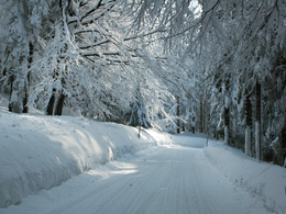
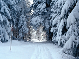
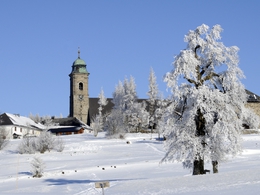
Very nice flat path through the snowy parish forest !
Refreshments: Gasthaus Scherrer, Panoramacafe Bauer, Gasthaus Höglinger
Walking time (there/back): 3 hours, 10 km
Starting place: 4141 Pfarrkirchen im Mühlkreis
Destination: 4141 Pfarrkirchen im Mühlkreis
duration: 1h 27m
length: 9,5 km
Altitude difference (uphill): 132m
Altitude difference (downhill): 145m
Lowest point: 794m
Highest point: 869m
difficulty: very easy
condition: very easy
panoramic view: Individual Views
Paths covering:
snow
further information:
- culinary interesting
- Possible accommodation
- Board possible
Details - hiking
- cleared winter hiking path
Parking
- Parking space: 30
- All weather
- Suitable for groups
- Suitable for schools
- Suitable for teenagers
- Suitable for seniors
- Suitable for single travelers
- Suitable for families
- Suitable for friends
- Suitable for couples
- Suitable for children
- Early winter
- Deep winter
Please get in touch for more information.
Pfarrkirchen 13
4141 Pfarrkirchen im Mühlkreis
Phone +43 7285 415
Fax machine +43 7285 415 - 4
E-Mail pfarrkirchen@oberoesterreich.at
Web www.donauregion.at/pfarrkirchen
http://www.donauregion.at/pfarrkirchen


