Naarn: Fuchtelmanderlweg Trail
Starting place: 4331 Naarn im Machlande
Destination: 4331 Naarn im Machlande


Flatly
Possible accommodation
Perger Straße 2
4331 Naarn im Machlande
4331 Naarn im Machlande

Short description:
Neuhof – Neuhofer Bridge – Hauswiesbrücke Bridge - Perg - Lanzenberg - Aisthofen - Altenhof - Au - Naarn
Neuhof – Neuhofer Bridge – Hauswiesbrücke Bridge - Perg - Lanzenberg - Aisthofen - Altenhof - Au - Naarn
Quality of experience: ****
Recommended season:
- April
- May
- June
- July
- August
- September
- October
Properties:
Description:- Loop
- Scenic
- Refreshment stops available
- Family friendly
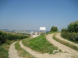
From the starting place in Naarn we cross the village and follow Perger Straße road. We cross the road, turn into Pratztrumer Straße road and keep the direction. We continue on the road past several farm houses and take a right turn at the next T-crossing. We follow this road and at a farm house we keep to the right and hike southwards. Near Baumgarten we keep to the left and walk to Neuhof and then to Neuhofer Bridge. We cross the bridge and follow Donausteig Trail against the signposting direction to Perg. We take a left turn at the cemetary (Kerngraben) and hike out of Perg to Weinzierl. There we follow again Donausteig Trail against the signposting direction and take a left turn in Heuhart to get back to Naarn.Directions:
Vom Startplatz in Naarn ausgehend, durchqueren wir den Ort und folgen der Perger Straße. Wir überqueren die Straße und biegen in die Pratztrumer Str. ein deren Richtung wir beibehalten. Bei einer Ansammlung von Gehöften folgen wir der Straße weiter und biegen bei der nächsten T-Kreuzung rechts ab. Auf dieser Straße gehen wir weiter und halten uns bei einem Bauernhaus rechts Richtung Süden. Bei Baumgarten halten wir uns links gehen nach Neuhof und in weiterer Folge zur Neuhofer Brücke. Diese überqueren wir und folgen dem Donausteig gegen die Beschilderungsrichtung nach Perg. Beim Friedhof biegen wir links ab (Kerngraben) und wandern aus Perg hinaus nach Weinzierl. Hier folgen wir wieder gegen die Beschilderungsrichtung dem Donausteig und biegen in Neuhart links ab zurück nach Naarn.Tip:
Journeys of discovery with an enjoyable stopover! This tour leads directly past the following culinary partner:
Equipment:
Wanderrucksack (inkl. Regenhülle), festes SchuhwerkAdditional information:
Tourist Board
Pergerstr. 2
4331 Naarn im Machlande
Tel.: 0043(0)7262/58255-0
Fax: 0043/(0)7262/58255-31
E-mail: gemeinde@naarn.ooe.gv.at
Starting place: 4331 Naarn im Machlande
Destination: 4331 Naarn im Machlande
duration: 7h 30m
length: 27,9 km
Altitude difference (uphill): 99m
Altitude difference (downhill): 102m
Lowest point: 236m
Highest point: 333m
difficulty: medium
condition: medium
panoramic view: Great panorama
Paths covering:
Asphalt, Path / trail, Gravel, Other
Starting point: Infopoint im Zentrum
Destination: Infopoint im Zentrum
further information:
- Flatly
- Possible accommodation
- Board possible
Gasthof Jägerwirt


Panoramablick Perg Kalvarienberg

Panoramablick Perg Stadler Gründe

Rastplatz Au

Rastplatz Neuhof-Holzpoint

Rastplatz Weinbau Gmeiner, Weinzierl
Seberner Brücke

Startplatz Naarn
Startplatz Naarn
")
")

")
")
")
")
")
")

Accessibility / arrival
Public Transit
www.postbus.at
Parking
At Marktplatz square, at the guesthouses, public car park of the municipality of Naarn i. M.
Getting there
By car: A1 autobahn to “Enns-Steyr” exit or “St. Valentin” to Mauthausen respectively (Danube bridge) – federal road no. 3 to Perg – Naarn junction.
By train: The next train station is in Perg, 4km from Naarn.
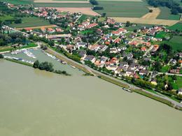
By boat: Au/Danube landing stage
Public Transit
www.postbus.at
Parking
At Marktplatz square, at the guesthouses, public car park of the municipality of Naarn i. M.
Most economical season
- Spring
- Summer
- Autumn
Please get in touch for more information.
Perger Straße 2
4331 Naarn im Machlande
Phone +43 7262 58255 - 0
E-Mail gemeinde@naarn.ooe.gv.at
Web www.donauregion.at/naarn
Web www.donauregion.at
https://www.donauregion.at/naarn
http://www.donauregion.at
http://www.donauregion.at
")
Altitude profile - Naarn: Fuchtelmanderlweg Trail
powered by TOURDATA