

Wur course - running & walking park - Red S4


- Flatly
Interactive elevation profile
Create PDF
Tour-Details
Starting place: 4582 Spital am Pyhrn
Destination: 4582 Spital am Pyhrn
duration: 1h 37m
length: 5,7 km
Altitude difference (uphill): 114m
Altitude difference (downhill): 114m
Lowest point: 640m
Highest point: 706m
difficulty: medium
condition: medium
panoramic view: Individual Views
Paths covering:
Gravel, Hiking trail
powered by TOURDATA
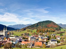
Runnersfun running & walking park in Spital am Pyhrn - Wur course - red S4
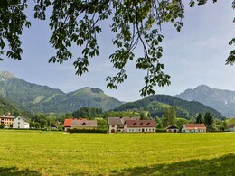
Beautiful, charming route which, after a short stretch through town, takes you through a peaceful area. Alongside the Wurberg, you will reach the golf course via a paved path. Here, the gray route gives you the option of going to Gasthaus Kaspar. Continue alongside the railway lines, past the farm, and back to the starting point.
Beautiful, charming route which, after a short stretch through town, takes you through a peaceful area. Alongside the Wurberg, you will reach the golf course via a paved path. Here, the gray route gives you the option of going to Gasthaus Kaspar. Continue alongside the railway lines, past the farm, and back to the starting point.
Starting point: park area collegiate church Spital am Pyhrn
Destination: park area collegiate church Spital am Pyhrn
further information:
- Flatly
- Board possible


")

Accessibility / arrival
Parking in the center of Spital am Pyhrn
Most economical season
- Spring
- Summer
- Autumn
Please get in touch for more information.

Stiftsplatz 1
4582 Spital am Pyhrn
Phone +43 7563 249
Fax machine +43 7563 249 - 20
E-Mail spital@pyhrn-priel.net
Web www.urlaubsregion-pyhrn-priel.at
https://www.urlaubsregion-pyhrn-priel.at
")
")
")
")
Interactive elevation profile
Create PDF
Tour-Details
Starting place: 4582 Spital am Pyhrn
Destination: 4582 Spital am Pyhrn
duration: 1h 37m
length: 5,7 km
Altitude difference (uphill): 114m
Altitude difference (downhill): 114m
Lowest point: 640m
Highest point: 706m
difficulty: medium
condition: medium
panoramic view: Individual Views
Paths covering:
Gravel, Hiking trail
powered by TOURDATA