

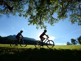
Alternative Windischgarsten - Spital am Pyhrn (R31)


- Suitable for families
Interactive elevation profile
Create PDF
Tour-Details
Path number: R31
Starting place: 4582 Spital am Pyhrn
Destination: 4580 Edlbach
duration: 0h 28m
length: 7,0 km
Altitude difference (uphill): 28m
Altitude difference (downhill): 47m
Lowest point: 637m
Highest point: 674m
difficulty: easy
condition: easy
panoramic view: Great panorama
Paths covering:
Asphalt, Gravel, Other
powered by TOURDATA
The bike path is a perfect connection and alternative for the connection of the National Park Kalkalpen Radeweges R31 between Windischgarsten and Spital am Pyhrn. Start is at the Radpoint at the parking lot of the panoramic indoor pool Spital am Pyhrn. Now we drive a little way along the bike path along the main road, under the railway bridge and then left.
Now the bike path leads along the Pyhrnbahn, past the golf course we come to the Hengstpass country road to the bike path R31.
Now the bike path leads along the Pyhrnbahn, past the golf course we come to the Hengstpass country road to the bike path R31.
Starting point: Panoramic indoor pool Spital am Pyhrn
Destination: Golf course - Hengstpass Landesstraße
Accessibility / arrival
Private:
Motorway A9-exit Spital am Pyhrn or B138, 500 m north of the town center
Public:
Take the ÖBB-Postbus (line 911) or the Postbus (line 430) to the stop Spital am Pyhrn Bahnhof junction - walking time approx. 3 minutes.
- Suitable for groups
- Suitable for schools
- Suitable for teenagers
- Suitable for seniors
- Suitable for single travelers
- Suitable for friends
- Suitable for couples
- Suitable for children
- Spring
- Summer
- Autumn
Please get in touch for more information.

Stiftsplatz 1
4582 Spital am Pyhrn
Phone +43 7563 249
Fax machine +43 7563 249 - 20
E-Mail spital@pyhrn-priel.net
Web www.urlaubsregion-pyhrn-priel.at
https://www.urlaubsregion-pyhrn-priel.at
Interactive elevation profile
Create PDF
Tour-Details
Path number: R31
Starting place: 4582 Spital am Pyhrn
Destination: 4580 Edlbach
duration: 0h 28m
length: 7,0 km
Altitude difference (uphill): 28m
Altitude difference (downhill): 47m
Lowest point: 637m
Highest point: 674m
difficulty: easy
condition: easy
panoramic view: Great panorama
Paths covering:
Asphalt, Gravel, Other
powered by TOURDATA