Almtal horseback riding path - Traunreiter - a fantastic horseback riding path net
Starting place: 4651 Stadl-Paura
Destination: 4645 Grünau im Almtal

a fantastic bridlepath
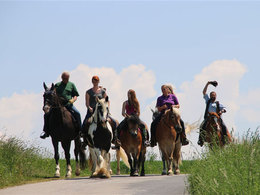
A paradisiac bridlepath network is created in a breathtaking landscape. Numerous restaurants and bars invite the trail riders to take a break along the way.The start is at the horse center Stadl-Paura, the place of issue of the Upper Austrian exhibition 2016 and leads us across forests and meadow paths in the direction of the family park "Agrarium" with its new highlight, the "Hummelflugschanze". Here is an resting place for the riders with a possibility to tether the horses.
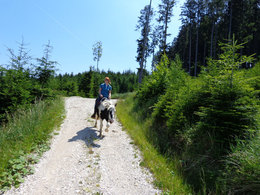
To continue on the fields and roads with stunning views of the Traunstein and the "Höllen-und Toten Gebirge) towards Vorchdorf, past the "Lust am Leben Adventure" (resting stop and food for horses and accommodation in the air-conditioned and heated teepee with shower and Pool) to the resteraunt "Wirt in the Edt" (rest stop with tethering possibility for horses, Tuesday is closed), then it goes under the A1 motorway on the Saddle Up Ranch in the direction of Theuerwanger forest, which we ride on quiet forest roads.
Crossing the river "Alm" near Eggenstein (Marktgemeinde Pettenbach), we ride towards Moos, past the farm Klingelmayr (resting stop and food for the horses + overnight accommodation), up in the direction of Bäckerberg, where we can stop off at the "snack station" Derischleiten (rest stop with possibility to connect horses).
Past the international Buddhist centre "Gomde", a little bit uphill we reach the high plateau of Hackelberg above Scharnstein, where we again have a wonderful view of the mountains and the Almtal. When Rathberg (here is also a turn towards St. Konrad possible) on the freight route "Birihub" to the equestrian center of the Almtaler riding and driving club (horse watering place), on the road "Dorfbühel". Then we cross the main road (Please be very careful!) Then turn left into the street "In der Haid", then slightly right through the forest at the airport Scharnstein (only gliders and motor gliders) past to the farm "Bühelbauer", the "Mayrhofstraße" left, cross the next road in the "forest path" to the next intersection, there we turn left into the street "Zu Brunn" and ride to the main street, there the structurally separate pedestrian and bike path towards the railway crossing Kothmühle (with lighting system , please be careful). After crossing the main road (in the direction of Grünau) and the "Almtalbahn", we turn left into "Grubbachstraße". Before the wooden bridge, the path goes right along the river "Alm". We follow this path until we come to the bridge at "Gangljodl". There you can ride under the bridge.
Then it goes along the "Almuferweges" to the bridge at "Landgasthof Schaiten", cross the bridge , then right the way along the Flösserweg, then left in the highway to the main road, cross this and turn into the Kefergasse and after approx. 300 meters is on the left side of the horse farm Mangstl, the end point of the hike. (Rest stop and food for horses) Overnight accommodation in the neighboring Pension Mittermayr in Grünau im Almtal.
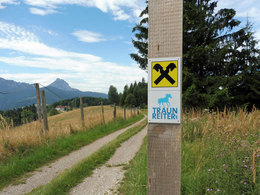
We stick to the Traunreiter FAIR PLAY RULES!
Starting place: 4651 Stadl-Paura
Destination: 4645 Grünau im Almtal
duration: 11h 34m
length: 42,4 km
Altitude difference (uphill): 682m
Altitude difference (downhill): 537m
Lowest point: 344m
Highest point: 772m
difficulty: medium
condition: medium
panoramic view: Great panorama
Paths covering:
Asphalt
Details riding
- Area: medium
- Good riding experience: medium
- Feeding possible for horses
- Housing possibility for horses
- Accommodations for riders
- horse trough
- paddock
Parking
- Parking space: 50
- All weather
- Suitable for groups
- Suitable for single travelers
- Suitable for friends
- Suitable for couples
- Spring
- Summer
- Autumn
Please get in touch for more information.
4651 Stadl-Paura
Phone +43 7616 8268
mobile +43 676 4944077
E-Mail office@traunreiter.at
Web www.traunreiter.at
Web traunsee-almtal.salzkammergut.at/
http://www.traunreiter.at
https://traunsee-almtal.salzkammergut.at/
https://traunsee-almtal.salzkammergut.at/
You can also visit us on
Facebook


