

The Vormauerstein Mountain "Gnome trail"


Interactive elevation profile
Create PDF
Tour-Details
Path number: Alle Neune - Tour 9
Starting place: 5360 St. Wolfgang im Salzkammergut
Destination: 5360 St. Wolfgang im Salzkammergut
duration: 5h 40m
length: 11,5 km
Altitude difference (uphill): 939m
Altitude difference (downhill): 938m
Lowest point: 558m
Highest point: 1.406m
difficulty: difficult
condition: difficult
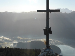
panoramic view: Great panorama
Paths covering:
Climbing mount, Hiking trail
powered by TOURDATA
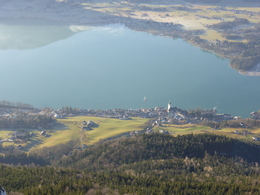
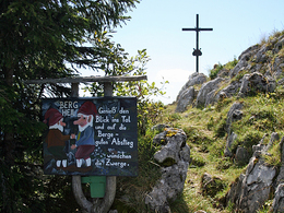
On the "Zwergerlweg" (the gnome trail) on the Vormauerstein Mountain.
Start off from Hotel Peter firstly in the direction of Lake Schwarzensee to the Mauruskapelle (wayside shrine), walk no. 28, then left on walk no. 27 to the Sommeraualm pastures (stamping point). Continue on the Vormaueralm pastures and left up to the craggy peak of the Vormauer rock. Descend westwards to the Vormauer path, walk no. 26, and down towards St. Wolfgang. The route to the summit leads past 10 gnome settlements!
Parking
- Parking space: 100
- Parking area for disabled: 2
- Bus parking space: 10
- Suitable for kids (6 - 10 Year)
- Spring
- Summer
- Autumn
Please get in touch for more information.
5360 St. Wolfgang im Salzkammergut
Phone +43 6138 8003
Fax machine +43 6138 8003 - 81
E-Mail stwolfgang@wolfgangsee.at
Web www.wolfgangsee.at
http://www.wolfgangsee.at
Interactive elevation profile
Create PDF
Tour-Details
Path number: Alle Neune - Tour 9
Starting place: 5360 St. Wolfgang im Salzkammergut
Destination: 5360 St. Wolfgang im Salzkammergut
duration: 5h 40m
length: 11,5 km
Altitude difference (uphill): 939m
Altitude difference (downhill): 938m
Lowest point: 558m
Highest point: 1.406m
difficulty: difficult
condition: difficult
panoramic view: Great panorama
Paths covering:
Climbing mount, Hiking trail
powered by TOURDATA