

Cycling tour Attersee - Mondsee


- Suitable for families
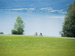
- Flatly
Interactive elevation profile
Create PDF
Tour-Details
Starting place: 4863 Seewalchen am Attersee
Destination: 4863 Seewalchen am Attersee
duration: 5h 15m
length: 74,9 km
Altitude difference (uphill): 565m
Altitude difference (downhill): 566m
Lowest point: 466m
Highest point: 552m
difficulty: easy
condition: medium
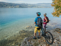
panoramic view: Great panorama
Paths covering:
Asphalt
powered by TOURDATA
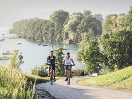
Welcome to the racing bike route Attersee - Mondsee!
From Seewalchen am Attersee further towards Unterach and over the Mondsee and back via Steinbach and Weyregg am Attersee to Seewalchen am Attersee leads this bike tour in the beautiful region. Along the way there are numerous opportunities to stop for refreshments.
The tour starts at Seewalchen and leads trough the landscape of the western shore of the lake due south via Attersee and Nußdorf to Unterach. At Unterach you have to drive to the Mondsee at the northern shore of the lake to the town Mondsee. At the south shore of the lake you can visit Schwarzindien, Plomberg and Schafling back to Unterach. There you branch off to the B152 and follow the south shore of the Attersee over Weißenbach, Steinbach, Seefeld and Weyregg back to Seewalchen.
Refreshment stops along the way:
Starting point: Attersee - road
Destination: Attersee - road
further information:
- Flatly
- Board possible
always
Accessibility / arrival
By car:
- From Salzburg via the A1 - Seewalchen exit continue on the B151
- From Vienna/Linz via the A1 - Seewalchen exit continue on the B151
- Coming from Salzburg via A1 - exit Mondsee
- Coming from Vienna/Linz via A1 - exit St. Georgen, Attersee via Nußdorf to Unterach
- Coming from the west - Bad Ischl-Weißenbach-Unterach
by train:
- Coming from Salzburg or Linz/Vienna to Vöcklamarkt, then with the Attergau-Bahn to Attersee, and with the bus to Unterach.
- Coming from Vöcklabruck by train to Kammer/Schörfling am Attersee, continue with bus line 561 to Seewalchen
by plane:
- Coming from Salzburg via the A1 - Mondsee exit.
- coming from Vienna/Linz via A1 - exit St. Georgen
Parking possibility Strandbad parking lot or in the center at the cemetery or shopping center
General price information
free
- Suitable for groups
- Suitable for schools
- Suitable for teenagers
- Suitable for seniors
- Suitable for single travelers
- Suitable for friends
- Suitable for couples
- Suitable for children
Cyclists and racing cyclists
Attention - for the most part you have to ride on the federal road
- Spring
- Summer
- Autumn
Please get in touch for more information.
Attergaustraße 55
4880 St. Georgen im Attergau
Phone +43 7666 7719 - 0
E-Mail info@attersee.at
Web attersee-attergau.salzkammergut.at
https://attersee-attergau.salzkammergut.at
You can also visit us on
Visit us on Facebook Visit us on Instagram Visit us on Pinterest Visit our videochannel on YouTube WikipediaInteractive elevation profile
Create PDF
Tour-Details
Starting place: 4863 Seewalchen am Attersee
Destination: 4863 Seewalchen am Attersee
duration: 5h 15m
length: 74,9 km
Altitude difference (uphill): 565m
Altitude difference (downhill): 566m
Lowest point: 466m
Highest point: 552m
difficulty: easy
condition: medium
panoramic view: Great panorama
Paths covering:
Asphalt
powered by TOURDATA