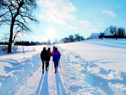
© Foto Oberösterreich Tourismus GmbH/Robert Maybach: Schneeschuwandern im Mühlviertel in der Nähe von Bad Zell.
Search
Search
Close

Altmünster-Gmundnerberg-Altmünster scenic circular walk

  • Suitable for families
  • Flatly

 Interactive elevation profile

Download GPS data
Create PDF

Tour-Details

Starting place: 4813 Altmünster
Destination: 4813 Altmünster

duration: 2h 35m
length: 7,0 km
Altitude difference (uphill): 384m
Altitude difference (downhill): 384m

Lowest point: 443m
Highest point: 818m
difficulty: easy
condition: easy
panoramic view: Great panorama

Paths covering:
Hiking trail

powered by TOURDATA

Altmünster-Gmundnerberg-Altmünster scenic circular walk

Town Altmünster-Stücklbach- upto fork to the right- uphill, steep cross road- long ascent through woods (you can do Urzn circular walk after you have crossed next road)-steep ascent to meadow - regional hospital or to the right Gmundnerberghaus or Gasthaus Urzn slight downhill walk along road barrier- left up to farmhouse- turn right into path through meadow- downhill through woods- Wasserfeldsiedlung-railroad crossing-road-Eggerhaus -SOS Children's Village-Altmünster, Walking time: 3 hours, difference in altitude:440m


Starting point: Town Altmünster
Destination: Altmünster

further information:
  • Flatly
  • Board possible

Accessibility / arrival

from the highway: departure Regau- in the direction of Bad Ischl-till Altmünster-turn into the center of Atlmünster

Parking
  • Parking space: 50
  • Parking area for disabled: 2
  • Bus parking space: 3
Travelling by public transport
Route planner for independent travellers
  • Suitable for groups
  • Suitable for schools
Most economical season
  • Spring
  • Summer
  • Autumn

Not suitable for wheelchairs. The property is not compliant with Austria's ÖNORM legal standard.


Altmünster-Gmundnerberg-Altmünster scenic circular walk
Tourismusbüro Altmünster
4813 Altmünster

Phone +43 7612 87181
Fax machine +43 7612 87141 - 45
E-Mail info@traunsee-almtal.at
Web www.traunsee-almtal.at/altmuenster
http://www.traunsee-almtal.at/altmuenster

We speak the following languages

German

 Interactive elevation profile

Download GPS data
Create PDF

Tour-Details

Starting place: 4813 Altmünster
Destination: 4813 Altmünster

duration: 2h 35m
length: 7,0 km
Altitude difference (uphill): 384m
Altitude difference (downhill): 384m

Lowest point: 443m
Highest point: 818m
difficulty: easy
condition: easy
panoramic view: Great panorama

Paths covering:
Hiking trail

powered by TOURDATA