Alp meadow trail
Starting place: 4893 Zell am Moos am Irrsee
Destination: 4893 Zell am Moos am Irrsee
Dr. Franz Müller Straße 3
4893 Zell am Moos am Irrsee
4893 Zell am Moos am Irrsee

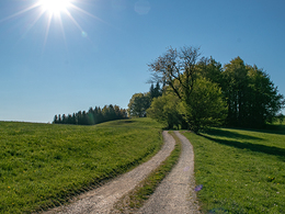
Nice walk through the alpine meadows above the municipality of Zell am Moos.
Starting/finishing point is the centre of Zell am Moos (Kirchenplatz). Cross the Kirchenplatz and pass the war memorial and painted limes - across the "Pfarrweg" through the underpass beneath the main road, walk along the Güterweg "Gassnerhof".
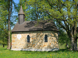
Stay a while and enjoy a first glimpse of Zell am Moos and the idyllic Irrsee. Follow the climbing Güterweg to the small village of Lindau. Then turn left and proceed to the Lindenbauernkapelle. Admire the wonderful landscape and the romantic chapel built in the shade of the trees.
Alternaive: If you want, you can take a short cut at Lindenbauernkapelle. To do this, turn left at the chapel and follow the Feldweg - past Oberlechnerhof and Feichtingerhof, until the path joins up again with the normal route (see below!).
The route leads from the Lindenbauernkapelle to Güterweg and down to the town of Harpoint, which lies in a valley, cross the Vöcka river and follow the Güterweg in the direction of Heissing. Cross the group of houses and after a few hundred metres you will reach the arnicameadow at Heissingerhöhe. You have now reached the further point on this walk. Enjoy the stillness of the surrounding nature an the wonderful view.
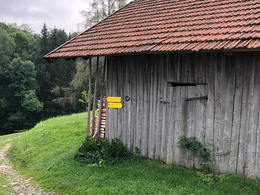
Return to Heissing and turn right into Feldweg to "BAstlingerhof". The route now leads to the centre of Haslau. The route turns left along Vöcklatal-Bezirksstraße. The narrow, almost traffic-free street winds along the Vöckla through the wood and connects the towns of Haslau and Harpoint. At "Bruckermüllnerhof" turn right over the Vöcklabridge and follow the slight climb up Feldweg throug a small wood over extensive meadows and fields, until Feldweg joins Vöcklatal-Bezirksstraße. The short cut from Lindenbauernkapelle also joins up here with the normal route.
Go straight along Vöcklatal-Bezirksstraße, after 100 m cross over and follow Feldweg to the junction. Turn left to the set of houses named "Ramsau". Note the excellent vistas along this route. Walk along Ramsauerbach to the Maier campsite and throught the town of Unterschwand to the north-eastern end of Zell am Moos. The route travels along Dorfstraße briefly before turning right. Follow the Irrsee shore to the car park for the pool and along Seestraße, which brings you back to the starting point. Use this opportunity to visit the Heimatmuseum "Mairhofer-Irrsee" in Zell am Moos (Opening times May 1st to October 31st - Friday, Saturday, Sunday and Monday 2 pm - 6 pm).
Accessibility / arrival
Drive from Zell am Moos towards Frankenmarkt. In the village Haslau (after approx. 3km) you park at the inn Stroblwirt and start your hike here.
- Parking space: 5
- All weather
- Suitable for kids (all ages)
- Suitable for seniors
- Suitable for single travelers
- Suitable for friends
- Suitable for couples
- Spring
- Summer
- Autumn
Please get in touch for more information.
Dr. Franz Müller Straße 3
4893 Zell am Moos am Irrsee
Phone +43 6232 2270
Fax machine +43 6232 2270 - 22
E-Mail info@mondsee.at
Web mondsee.salzkammergut.at
https://mondsee.salzkammergut.at


