

Hike to the Schafbergalm (alp)
 | © TVB Mondsee-Irrsee")


Interactive elevation profile
Create PDF
Tour-Details
Path number: 17
Starting place: 5310 Scharfling am Mondsee
Destination: 5310 Scharfling am Mondsee
duration: 7h 18m
length: 10,1 km
Altitude difference (uphill): 1.329m
Altitude difference (downhill): 1.322m
Lowest point: 520m
Highest point: 1.348m
difficulty: difficult
condition: difficult
panoramic view: Great panorama
Paths covering:
Gravel, Hiking trail, Other
powered by TOURDATA
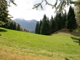
A strenuous but very scenic hike from the Scharflinger Höhe to the Schafbergalm.
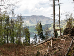
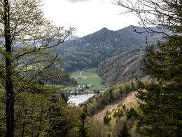
From the car park on the Scharflinger Höhe, we hike steeply uphill through the hillside forest for the first part. After the first section it becomes a little flatter and we come to a small meadow - the Kesselalm. We continue on the hiking trail between Kesselkopf and Butterwand until we come across a forest road again. From here we can already see the steep rock face of the Schafberg towering up, below which we still have to climb a few meters to reach the Schafbergalm.
Starting point: Scharflinger height
Destination: Schafbergalm (alp)
Accessibility / arrival
The starting point for this tour is at the Scharflingerhöhe (by car from Mondsee in the direction of St. Gilgen). There are some parking spaces available.
- Parking space: 5
none
- Suitable for friends
- Suitable for couples
- Spring
- Summer
- Autumn
- Early winter
Please get in touch for more information.
Dr. Franz Müller Str. 3
5310 Mondsee am Mondsee
Phone +43 6232 2270
E-Mail info@mondsee.at
Web www.mondsee.at
https://www.mondsee.at
Interactive elevation profile
Create PDF
Tour-Details
Path number: 17
Starting place: 5310 Scharfling am Mondsee
Destination: 5310 Scharfling am Mondsee
duration: 7h 18m
length: 10,1 km
Altitude difference (uphill): 1.329m
Altitude difference (downhill): 1.322m
Lowest point: 520m
Highest point: 1.348m
difficulty: difficult
condition: difficult
panoramic view: Great panorama
Paths covering:
Gravel, Hiking trail, Other
powered by TOURDATA