

Kräutergraben circular path


- Suitable for families
- Flatly
Interactive elevation profile
Create PDF
Tour-Details
Starting place: 4785 Freinberg
Destination: 4785 Freinberg
duration: 1h 15m
length: 4,2 km
Altitude difference (uphill): 120m
Altitude difference (downhill): 120m
Lowest point: 350m
Highest point: 470m
difficulty: medium
condition: difficult
panoramic view: Dreamtour
Paths covering:
Asphalt, Path / trail, Street
powered by TOURDATA
Short description:
Nature hike to the most scenic viewpoints in Freinberg
Nature hike to the most scenic viewpoints in Freinberg
Technique: **
Quality of experience: *****
Recommended season:
- March
- April
- May
- June
- July
- August
- September
- October
- November
Properties:
- Loop
- Scenic
- Refreshment stops available
- Family friendly
- Botanical highlights
- Faunistic highlights
- Insider tip
Seal of approval:
- Quality route according to "Österreichisches Wandergütesiegel"
The idyllic hike through the deep forest trench of Kräutergraben stream takes you along forest trails and footpaths to the most scenic viewpoints in Freinberg. The breathtaking view of the tri-river town of Passau and the Sauwald idyll with the lush meadows, welltended fields and scattered farmsteads make this hike a true experience.
Tip:
A detour to the bees nature trail at the old forester`s lodge is highly suited for families and all honey fans, and definitely recommended. Everything about the origin and production of the sweet gold.
Equipment:
Hiking backpack (incl. rain cover), sturdy shoes
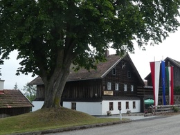
Starting point: Local square Freinberg
Destination: Local square Freinberg
further information:
- Flatly
- Board possible
Accessibility / arrival
Parking
on site
Public Transit
Location and getting there
How to arrive in the Danube Upper Austrian region?
The fast way to your destination – by train, bus, car, boat or plane.
Parking
on site
Most economical season
- Spring
- Summer
- Autumn
- Early winter
Please get in touch for more information.
Freinberg 4
4785 Freinberg
Phone +43 7713 8102 - 0
E-Mail gemeinde@freinberg.ooe.gv.at
Web www.freinberg.at
https://www.freinberg.at
Interactive elevation profile
Create PDF
Tour-Details
Starting place: 4785 Freinberg
Destination: 4785 Freinberg
duration: 1h 15m
length: 4,2 km
Altitude difference (uphill): 120m
Altitude difference (downhill): 120m
Lowest point: 350m
Highest point: 470m
difficulty: medium
condition: difficult
panoramic view: Dreamtour
Paths covering:
Asphalt, Path / trail, Street
powered by TOURDATA