

Countess Trail (nature trail)


- Suitable for families
- Flatly
Interactive elevation profile
Create PDF
Tour-Details
Starting place: 4091 Vichtenstein
Destination: 4091 Vichtenstein
duration: 1h 0m
length: 3,2 km
Altitude difference (uphill): 95m
Altitude difference (downhill): 95m
Lowest point: 539m
Highest point: 638m
difficulty: easy
condition: very easy
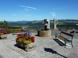
panoramic view: Dreamtour
Paths covering:
Asphalt, Other
powered by TOURDATA
Short description:
The hiking route is about 3.25 km long, of which about half of the distance is designed as a nature trail
The hiking route is about 3.25 km long, of which about half of the distance is designed as a nature trail
Technique: *
Quality of experience: ****
Recommended season:
- March
- April
- May
- June
- July
- August
- September
- October
Properties:
- Loop
- Scenic
- Refreshment stops available
- Family friendly
- Botanical highlights
Viewing platform in front of the town hall – past Vichtenstein Castle - Danube Trail rest area "Teich" - crossing the state road - after some 200 m crossing a meadow - and continue following the signs for Komtessenweg to the starting point
Tip:
Enjoy peace and relaxation at the Danube Trail rest area "Teich" and listen to the water babbling
Equipment:
Hiking backpack (incl. rain cover), sturdy shoes
Additional information:
Points of interest along the hiking trail:
- Vichtenstein Castle
- Vichtenstein Parish Church
- "Hannerl Chapel"
- Donausteig resting place "Pond
Starting point: Vichtenstein municipal office
Destination: Vichtenstein municipal office
further information:
- Flatly
- Board possible
Accessibility / arrival
Parking
Starting point
Public Transit
How to arrive in the Danube Upper Austrian region?
The fast way to your destination – by train, bus, car, boat or plane.
Parking
Starting point
Most economical season
- Spring
- Summer
- Autumn
Please get in touch for more information.
Vichtenstein 70
4091 Vichtenstein
Phone +43 7714 8055
E-Mail gemeinde@vichtenstein.ooe.gv.at
Web www.vichtenstein.at
http://www.vichtenstein.at
Interactive elevation profile
Create PDF
Tour-Details
Starting place: 4091 Vichtenstein
Destination: 4091 Vichtenstein
duration: 1h 0m
length: 3,2 km
Altitude difference (uphill): 95m
Altitude difference (downhill): 95m
Lowest point: 539m
Highest point: 638m
difficulty: easy
condition: very easy
panoramic view: Dreamtour
Paths covering:
Asphalt, Other
powered by TOURDATA