

natur.BANK.wege | Großraming | Three pictures - Anlaufalm | 446308


- Suitable for families
Interactive elevation profile
Create PDF
Tour-Details
Starting place: 4463 Großraming
Destination: 4463 Großraming
duration: 1h 24m
length: 4,0 km
Altitude difference (uphill): 380m
Altitude difference (downhill): 4m
Lowest point: 522m
Highest point: 900m
difficulty: medium
condition: medium
panoramic view: Dreamtour
Paths covering:
Path / trail, Gravel
powered by TOURDATA
Short description:
On the way to the Anlaufalm
On the way to the Anlaufalm
Quality of experience: ****
Recommended season:
- May
- June
- July
- August
- September
- October
- November
Properties:
- Refreshment stops available
- Family friendly
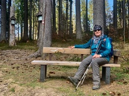
Hike to the sunny Anlaufalm in the Reichraminger Hintergebirge.
Directions:
The car park in front of the barrier is our starting point. From here you hike straight ahead on the flat forest road in the direction of the Hirschkogelsattel. After the turnoff, the forest road becomes steeper until you pass a hunting lodge after 200 pulsating metres of altitude. About 50 metres after a forest road junction, turn right onto a forest path that leads to the "Three Pictures".
Tip:
Be sure to continue on to the Anlaufalm. There you have a wonderful view of the Reichraminger Hintergebirge and, above all, you can enjoy homemade delicacies at the alpine pasture.
Additional information:
Refreshment stops in the vicinity
Starting point: Brunnbach - car park barriers
Destination: nature.bank.away 'Three pictures
further information:
- Board possible
Accessibility / arrival
Getting there
From Großraming by car in the direction of Sünden in the Brunnbach (approx. 10 km from Großraming station).
Parking
Parking at the barrier
Most economical season
- Spring
- Summer
- Autumn
- Early winter
Please get in touch for more information.
Stadtplatz 27
4400 Steyr
Phone +43 7252 53229 - 0
E-Mail info@steyr-nationalpark.at
Web www.steyr-nationalpark.at/
https://www.steyr-nationalpark.at/
Interactive elevation profile
Create PDF
Tour-Details
Starting place: 4463 Großraming
Destination: 4463 Großraming
duration: 1h 24m
length: 4,0 km
Altitude difference (uphill): 380m
Altitude difference (downhill): 4m
Lowest point: 522m
Highest point: 900m
difficulty: medium
condition: medium
panoramic view: Dreamtour
Paths covering:
Path / trail, Gravel
powered by TOURDATA