

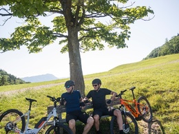
MTB - Feitelrundweg


- Flatly
Interactive elevation profile
Create PDF
Tour-Details
Starting place: 4453 Ternberg
Destination: 4453 Ternberg
duration: 4h 30m
length: 34,7 km
Altitude difference (uphill): 1.022m
Altitude difference (downhill): 1.022m
Lowest point: 326m
Highest point: 1.033m
difficulty: medium
condition: medium
panoramic view: Individual Views
Paths covering:
Asphalt, Gravel, Street
powered by TOURDATA
Short description:
Hearty mountain tour that leads over one of the steepest stretches of road in Austria.
Hearty mountain tour that leads over one of the steepest stretches of road in Austria.
Recommended season:
- April
- May
- June
- July
- August
- September
- October
Properties:
- Loop
Route: Trattenbach - Schreibachfall - Grünburgerhütte - Dorngraben - Steinbach - Schweinsegg - Ternberg.It is possible to stop at the Grünburger Hütte.
Directions:
Route: Trattenbach - Schreibachfall - Grünburgerhütte - Dorngraben - Steinbach - Schweinsegg - Ternberg. It is possible to stop at the Grünburger Hütte.
Safety guidelines:
Inquire in advance about any road or trail closures along the route.
Equipment:
Sun and rain protection, repair kid for minor bike breakdowns
Additional information:
You can obtain map material at www.steyr-nationalpark.at
Starting point: Trattenbach
Destination: Trattenbach
further information:
- Flatly
details mountainbike
- Riding technique: medium
- Suitable for groups
- Suitable for teenagers
- Suitable for single travelers
- Suitable for friends
- Suitable for couples
- Spring
- Summer
- Autumn
Please get in touch for more information.
Stadtplatz 27
4400 Steyr
Phone +43 7252 53229 - 0
E-Mail reichraming@steyr-nationalpark.at
Web www.steyr-nationalpark.at/
https://www.steyr-nationalpark.at/
Interactive elevation profile
Create PDF
Tour-Details
Starting place: 4453 Ternberg
Destination: 4453 Ternberg
duration: 4h 30m
length: 34,7 km
Altitude difference (uphill): 1.022m
Altitude difference (downhill): 1.022m
Lowest point: 326m
Highest point: 1.033m
difficulty: medium
condition: medium
panoramic view: Individual Views
Paths covering:
Asphalt, Gravel, Street
powered by TOURDATA