MTB - Eidenberger Alm route


Recommended season:
- April
- May
- June
- July
- August
- September
- October
- Loop
- Scenic
- Refreshment stops available
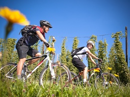
The route starts at the Eidenberger Alm, but you can join at any point along the trail.
Right at the beginning, you reach the highest point of the route, the GIS, where you are rewarded with a magnificent panoramic view over Upper Austria and western Lower Austria all the way to the Alps. The route then continues via Lichtenberg to Koglerau with the beautiful view of the Danube, just a short detour from the route (approx. 30m). The loop continues to Gramastetten, from there into the Rodltal and along the Ranitzbach. The Mühlviertel hills go up and down until you reach Untergeng, from where it continuously ascends back to the Eidenberger Alm.
There are places to stop for refreshments along the route or at the Eidenberger Alm.


- Spring
- Summer
- Autumn
Please get in touch for more information.
Lindengasse 9
4040 Linz
Phone +43 732 7277 - 800
Fax machine +43 732 7277 - 804
E-Mail info@donauregion.at
Web www.donauregion.at