

MTB - Mühltal circuit


- All weather
- Flatly
Interactive elevation profile
Create PDF
Tour-Details
Starting place: 4115 Kleinzell im Mühlkreis
Destination: 4115 Kleinzell im Mühlkreis
duration: 10h 0m
length: 80,7 km
Altitude difference (uphill): 2.180m
Altitude difference (downhill): 2.180m
Lowest point: 281m
Highest point: 675m
difficulty: difficult
condition: very difficult
panoramic view: Dreamtour
powered by TOURDATA
Short description:
Anspruchsvolle Tagestour mit knackige Höhenmetern und Abfahrten in den Tälern der Großen und Kleinen Mühl sowie den dazwischenliegenden Höhenrücken.
Technique: ***
Quality of experience: ******
Recommended season:
- April
- May
- June
- July
- August
- September
- October
Properties:
- Loop
- Scenic
- Refreshment stops available
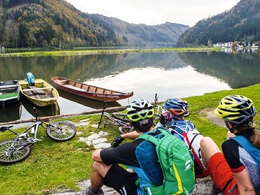
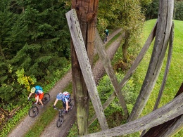
The MTB tour starts at the village square of Kleinzell. Past the Resilacke you ride to St. Martin, through the Mühlviertel hills down to the Danube to Untermühl. Into the valley of the Große Mühl, past the Partenstein power plant, steeply uphill to Ramersberg and down to the Große Mühl (Ebenmühle). 400 am bring you up to Kirchberg and the Burgstall lookout tower. Descent to Oberühl, from where it goes up to Altenfelden through Hühnergeschrei, several villages of the municipality of Arnreit and along the Froschbach back into the valley of the Great Mühl. Continue down the Mühl to Iglbach, up to Etzerreit, down to the Neufelden reservoir and back up to Apfelsbach and back to Kleinzell.
Starting point: Ortsplatz Kleinzell
Destination: Ortsplatz Kleinzell
further information:
- Flatly
- Board possible
- All weather
- Suitable for groups
- Suitable for seniors
- Suitable for single travelers
- Suitable for friends
- Suitable for couples
- Spring
- Summer
- Autumn
Please get in touch for more information.
Markt 2
4113 St. Martin im Mühlkreis
Phone +43 7232 2105
E-Mail gemeindeamt@sankt-martin.at
Web www.tourismus-sankt-martin.at
http://www.tourismus-sankt-martin.at
Interactive elevation profile
Create PDF
Tour-Details
Starting place: 4115 Kleinzell im Mühlkreis
Destination: 4115 Kleinzell im Mühlkreis
duration: 10h 0m
length: 80,7 km
Altitude difference (uphill): 2.180m
Altitude difference (downhill): 2.180m
Lowest point: 281m
Highest point: 675m
difficulty: difficult
condition: very difficult
panoramic view: Dreamtour
powered by TOURDATA