

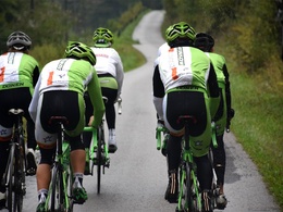
Rennradtour Kreuzgruberhöhe


- Flatly
Interactive elevation profile
Create PDF
Tour-Details
Starting place: 4453 Ternberg
Destination: 4453 Ternberg
duration: 7h 13m
length: 99,9 km
Altitude difference (uphill): 1.269m
Altitude difference (downhill): 1.236m
Lowest point: 286m
Highest point: 748m
difficulty: medium
condition: medium
panoramic view: Some Views
Paths covering:
Asphalt, Path / trail, Gravel, Street, Hiking trail, Other
powered by TOURDATA
Short description:
The tour starts at Steyr train station.
The tour starts at Steyr train station.
Recommended season:
- April
- May
- June
- July
- August
- September
- October
Properties:
- Loop
- Refreshment stops available
Starting from Steyr.
Directions:
The tour starts in Steyr and leads from there via Bahnhofstraße to the Ennskai, which you follow to the lower Schiffweg. Along the Enns you go to the power station Garsten. From there the tour leads to the Ennsradweg (Lahrndorfer Straße), which you follow via Ternberg/Trattenbach, Losenstein and Großraming to Weyer (Kastenreith).
After the Ennsmuseum (currently closed) and the Katzensteinermühle, the route continues along the railroad promenade through Weyer. Shortly after the climbing hall 6a you turn left to Lindau and drive via Großgschnaidt in the direction of Konradsheim. After the turnoff Maria Neustift - Gaflenz you turn left over the Kreuzgruberhöhe. The tour continues through the Ramingtal valley to Kleinraming and from there via Seitenstettner Straße and Haratzmüllerstraße back to Steyr station.
Safety guidelines:
Inquire in advance about any trail or road closures along the route.
Equipment:
Sun and rain protection, repair kid for minor bike breakdowns.
Additional information:
You can obtain up-to-date map material at www.steyr-nationalpark.at
Starting point: Steyr
Destination: Steyr
further information:
- Flatly
- Board possible
- Suitable for seniors
- Suitable for single travelers
- Suitable for friends
- Suitable for couples
- Spring
- Summer
- Autumn
Please get in touch for more information.
Stadtplatz 27
4400 Steyr
Phone +43 7252 53229 - 0
E-Mail info@steyr-nationalpark.at
Web www.steyr-nationalpark.at/
https://www.steyr-nationalpark.at/
Interactive elevation profile
Create PDF
Tour-Details
Starting place: 4453 Ternberg
Destination: 4453 Ternberg
duration: 7h 13m
length: 99,9 km
Altitude difference (uphill): 1.269m
Altitude difference (downhill): 1.236m
Lowest point: 286m
Highest point: 748m
difficulty: medium
condition: medium
panoramic view: Some Views
Paths covering:
Asphalt, Path / trail, Gravel, Street, Hiking trail, Other
powered by TOURDATA