

Orte des Glaubens: Besinnlicher Weg auf die Alm


- Suitable for families
Interactive elevation profile
Create PDF
Tour-Details
Path number: 29
Starting place: 5310 St. Lorenz am Mondsee
Destination: 5310 St. Lorenz am Mondsee
duration: 6h 39m
length: 13,6 km
Altitude difference (uphill): 535m
Altitude difference (downhill): 535m
Lowest point: 480m
Highest point: 1.015m
difficulty: medium
condition: medium
panoramic view: Individual Views
Paths covering:
Asphalt, Gravel, Hiking trail, Other
powered by TOURDATA
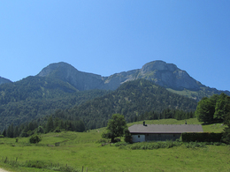
Attention mountain bikers - this trail can also be travelled by bike with a small diversions. From the bus stop, first take the road towards Holzingerbauer, where you will find the Holzinger "Marterl" (item 316), the Kienberger house blessing (item 317) and the Thaddäus chapel (item 318). From there, the marked farm track leads briefly steeply uphill to the forest road, the mountain bike and hiking trail to the Eisenaualm. If you park at the Scharfling pass road, follow the mountain bike trail from there (forest road to the Eisenaualm), but you will not reach items 316 to 318. All the other places of faith indicated are located on the forest road. The best way back is the same as the ascent, alternatively you can also return to Kreuzstein (item 310) on hiking trail no. 19, but the way back to Scharfling is on the road or cycle path.
")
")
")
")
")
")
")
")
")
Parking
- Parking space: 10
- Bus parking space: 1
- Suitable for groups
- Suitable for teenagers
- Suitable for seniors
- Suitable for single travelers
- Suitable for friends
- Suitable for couples
- Spring
- Summer
- Autumn
- Early winter
Please get in touch for more information.
Kirchengasse 1
5310 Mondsee am Mondsee
Phone +43 6232 4166
E-Mail pfarre.mondsee@dioezese-linz.at
Web www.pfarre-mondsee.com
http://www.pfarre-mondsee.com
Interactive elevation profile
Create PDF
Tour-Details
Path number: 29
Starting place: 5310 St. Lorenz am Mondsee
Destination: 5310 St. Lorenz am Mondsee
duration: 6h 39m
length: 13,6 km
Altitude difference (uphill): 535m
Altitude difference (downhill): 535m
Lowest point: 480m
Highest point: 1.015m
difficulty: medium
condition: medium
panoramic view: Individual Views
Paths covering:
Asphalt, Gravel, Hiking trail, Other
powered by TOURDATA