

St. Georgen/Walde route no. M1


- Suitable for families
- Flatly
Interactive elevation profile
Create PDF
Tour-Details
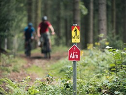
Path number: M1
Starting place: 4372 St. Georgen am Walde
Destination: 4372 St. Georgen am Walde
duration: 2h 44m
length: 30,4 km
Altitude difference (uphill): 1.113m
Highest point: 887m
difficulty: medium
condition: medium
panoramic view: Dreamtour
Paths covering:
Asphalt, Hiking trail
powered by TOURDATA
The mountain bike route starts in Linden and takes you via Erlau and Rempersdorf back to Linden. Biker will be rewarded with gorgeous views in many places. A worthwhile destination is also the 949-metre Burgstall directly next to the trail before heading back to the town of Linden. Route description:
The route leads around St. Georgen am Walde. Shortly after the start at the WaldReich pavilion, you leave St. Georgen am Walde and enter the village of Linden. In Ebenedt, cyclists also pass through the municipality of Königswiesen for the first time. The route leads via Henndorf to Unter St. Georgen. On the edge of the municipality of Dimbach, cyclists pedal via Großerlau to the 949 metre high Burgstall. From this section onwards, you have already completed two thirds of the route. Now it's downhill to the Gebetsberger snack station. After a short stop for refreshments, the mountain bike route leads back to the starting point in St. Georgen am Walde.
Starting point: Town of Linden, Gasthof Klaus (Klaus Inn)
Destination: Town of Linden, Gasthof Klaus (Klaus Inn)
further information:
- Flatly
- Suitable for groups
- Suitable for teenagers
- Suitable for single travelers
- Suitable for friends
- Suitable for couples
- Spring
- Summer
- Autumn
Please get in touch for more information.
4372 St. Georgen am Walde
Phone +43 50 7263 - 31
E-Mail anfrage@muehlviertel.at
Web www.muehlviertel-urlaub.at/bike
https://www.muehlviertel-urlaub.at/bike
Interactive elevation profile
Create PDF
Tour-Details
Path number: M1
Starting place: 4372 St. Georgen am Walde
Destination: 4372 St. Georgen am Walde
duration: 2h 44m
length: 30,4 km
Altitude difference (uphill): 1.113m
Highest point: 887m
difficulty: medium
condition: medium
panoramic view: Dreamtour
Paths covering:
Asphalt, Hiking trail
powered by TOURDATA