© Photo: Oberösterreich Tourismus GmbH./Robert Maybach: Enjoy the view in Upper Austria


Bad Ischl to Steeg (Soleweg)


- pets allowed
- All weather
- Suitable for families
- culinary interesting
- culturally interesting
Interactive elevation profile
Create PDF
Tour-Details
Path number: 9
Starting place: 4820 Bad Ischl
Destination: 4822 Bad Goisern am Hallstättersee
duration: 4h 0m
length: 21,0 km
Altitude difference (uphill): 400m
Altitude difference (downhill): 100m
Lowest point: 100m
Highest point: 400m
difficulty: easy
condition: medium
panoramic view: No view
Paths covering:
Asphalt, Gravel, Hiking trail
powered by TOURDATA
Path along the historic brine pipeline from Bad Ischl to Steeg.
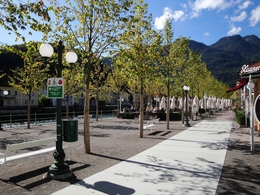
From the starting point, walk through the Pfarrgasse and along the Esplanade
Follow the River Traun to a natural monument the Kaltenbachteich by a new road bridge (previously the crossing place of the local railway line). Just before a wooden chapel keep right and
go through the Kaltenbachau until finally reaching the ski jump training centre on the Soleweg. Follow the Soleweg (left) passing the Kaiserstandbild, a statue built in 1910 to commemorate the 80th birthday of Emperor Franz Joseph (left and below the main path). Follow the shaded Soleweg and then an asphalted road Engleithenstraße, before reaching the historic village of Lauffen (bus and railway station). Continue on the Soleweg passing the "Wild Lauffen", formerly used in the navigation of salt along the River Traun.
Wander through large meadows coming to the houses in the village Weissbach in Bad Goisern. Follow an asphalt road and rejoin the Soleweg by an Inn. Here the yellow signs end, follow the signs "Soleweg" to Bad Goisern (bus and railway station).
further information:
- culinary interesting
Details - hiking
- themed path
- All weather
- Suitable for groups
- Suitable for schools
- Pets allowed
- Suitable for families
- Spring
- Summer
- Autumn
Please get in touch for more information.
")
Auböckplatz 5
4820 Bad Ischl
Phone +43 6132 27757
E-Mail office@badischl.at
Web www.badischl.at
http://www.badischl.at
Interactive elevation profile
Create PDF
Tour-Details
Path number: 9
Starting place: 4820 Bad Ischl
Destination: 4822 Bad Goisern am Hallstättersee
duration: 4h 0m
length: 21,0 km
Altitude difference (uphill): 400m
Altitude difference (downhill): 100m
Lowest point: 100m
Highest point: 400m
difficulty: easy
condition: medium
panoramic view: No view
Paths covering:
Asphalt, Gravel, Hiking trail
powered by TOURDATA