

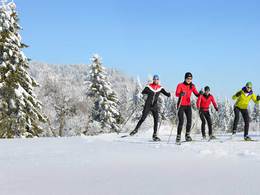
Brunnwaldloipe


- Flatly
Interactive elevation profile
Create PDF
Tour-Details
Starting place: 4183 Traberg
Destination: 4183 Traberg
duration: 1h 55m
length: 7,0 km
Altitude difference (uphill): 118m
Altitude difference (downhill): 119m
Lowest point: 737m
Highest point: 848m
difficulty: medium
condition: medium
panoramic view: Some Views
Paths covering:
snow
powered by TOURDATA
Trail not in operation
We share common tracesThe Zwettl, Oberneukirchen, Waxenberg, Traberg cross-country ski trails offer trails of all lengths and levels of difficulty.
No matter where you start the cross-country ski run, you will find connections to the entire network of cross-country ski runs in the municipalities. 45 kilometers of well-groomed trails for classic cross-country skiers but also for sporty skaters can be found in the hilly landscape around the four towns.
Cozy inns and cafes invite you to fortify yourself after the effort.
You can get information about the current cross-country skiing situation at the cross-country park, phone: +43 (0) 7212 / 7055-12.
Starting point: Gasthaus Kastner
further information:
- Flatly
Details - Trail
- Nordic skiing facilities: Marked Nordic skiing run
- Type of Nordic skiing run: Classic style
- free
With suitable snow conditions.
General price information
voluntary donation
Most economical season
- Early winter
- Deep winter
Please get in touch for more information.
4183 Traberg
Phone +43 7212 7055 - 12
E-Mail gemeinde@oberneukirchen.ooe.gv.at
Web www.bergfex.at/oberoesterreich/lang…
https://www.bergfex.at/oberoesterreich/langlaufen/muehlviertler-hochland/loipen/2823/
Interactive elevation profile
Create PDF
Tour-Details
Starting place: 4183 Traberg
Destination: 4183 Traberg
duration: 1h 55m
length: 7,0 km
Altitude difference (uphill): 118m
Altitude difference (downhill): 119m
Lowest point: 737m
Highest point: 848m
difficulty: medium
condition: medium
panoramic view: Some Views
Paths covering:
snow
powered by TOURDATA