

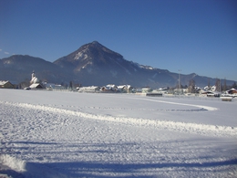
Cross-country skiing slope "Kesselboden"


Interactive elevation profile
Create PDF
Tour-Details
Starting place: 4645 Grünau im Almtal
Destination: 4645 Grünau im Almtal
duration: 0h 39m
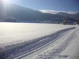
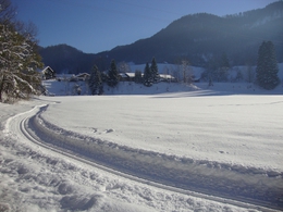
length: 2,6 km
Altitude difference (uphill): 11m
Altitude difference (downhill): 9m
Lowest point: 516m
Highest point: 528m
difficulty: easy
condition: easy
panoramic view: Some Views
Paths covering:
snow
powered by TOURDATA
Trail not in operation
An insider tipCross-country skiing in Grünau im Almtal is considered an insider tip in the Salzkammergut.
Thanks to the extensive range of winter sports on offer, Grünau has become a popular winter destination for those seeking relaxation. There are around 5 kilometers of cross-country ski trails in the Grünau area, and further cross-country ski trails start from the airfield in Scharnstein.
With a wonderful view, you can ski throughout the entire winter season.
Starting point: near the sports area and Kesselboden
Details - Trail
- Nordic skiing facilities: Marked Nordic skiing run
- Type of Nordic skiing run: Classic style
- free
The opening times depend on the weather conditions.
Most economical season
- Early winter
- Deep winter
Please get in touch for more information.
Im Dorf 17
4645 Grünau im Almtal
Phone +43 7616 8268
Fax machine +43 7616 8895
E-Mail almtal@traunsee-almtal.at
Web www.traunsee-almtal.at
https://www.traunsee-almtal.at
Interactive elevation profile
Create PDF
Tour-Details
Starting place: 4645 Grünau im Almtal
Destination: 4645 Grünau im Almtal
duration: 0h 39m
length: 2,6 km
Altitude difference (uphill): 11m
Altitude difference (downhill): 9m
Lowest point: 516m
Highest point: 528m
difficulty: easy
condition: easy
panoramic view: Some Views
Paths covering:
snow
powered by TOURDATA