

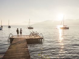
Weissenbachtal cycle way R15


Interactive elevation profile
Create PDF
Tour-Details
Path number: R15
Starting place: 4866 Unterach am Attersee
Destination: 4820 Bad Ischl
duration: 1h 46m
length: 52,0 km
Altitude difference (uphill): 212m
Altitude difference (downhill): 202m
Lowest point: 460m
Highest point: 572m
difficulty: medium
condition: medium
panoramic view: No view
Paths covering:
Asphalt, Gravel
powered by TOURDATA
The "Weissenbachtal" is a true insider tip of the Salzkammergut.
The Weißenbachtal cycle path leads from Weißenbach am Attersee relatively parallel to the main road through the wild and romantic valley Weißenbachtal. The gravel bike path leads over long stretches through a wooded area near the Weißenbach.
The last section through the Weißenbachtal has to be absolved on the main road, then you can continue on the Salzkammergut cycle path to Bad Ischl.
Signage: R15 (within the framework of the Upper Austrian National Road Network)
For the experienced cyclist!
Accessibility / arrival
by car:
Coming from Salzburg via the A1 - exit Mondsee, to Unterach,from Unterach to Weissenbach
Coming from Vienna/Linz via the A1 - exit St. Georgen, Attersee via Nußdorf to Unterach
Coming from the west - Bad Ischl-Weißenbach
by train:
Coming from Salzburg or Linz/Vienna to Vöcklamarkt, then with the Attergau train to Attersee and by bus to Unterach and then to Weissenbach
by plane:
Coming from Salzburgvia the A1 - exit Mondsee
Coming from Vienna/Linz via the A1 - exit St. Georgen
General price information
Free of charge
Most economical season
- Summer
Please get in touch for more information.
Steinbach 5
4853 Steinbach am Attersee
Phone +43 7666 7719 - 60
E-Mail info.steinbach@attersee.at
Web attersee-attergau.salzkammergut.at
https://attersee-attergau.salzkammergut.at
You can also visit us on
Visit us on Facebook Visit our videochannel on YouTube WikipediaInteractive elevation profile
Create PDF
Tour-Details
Path number: R15
Starting place: 4866 Unterach am Attersee
Destination: 4820 Bad Ischl
duration: 1h 46m
length: 52,0 km
Altitude difference (uphill): 212m
Altitude difference (downhill): 202m
Lowest point: 460m
Highest point: 572m
difficulty: medium
condition: medium
panoramic view: No view
Paths covering:
Asphalt, Gravel
powered by TOURDATA