

Kalkalpen National Park Bike Path R31


Interactive elevation profile
Create PDF
Tour-Details
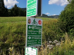
Path number: R31
Starting place: 4572 St. Pankraz
Destination: 8943 Unterlaussa
duration: 4h 28m
length: 40,0 km
Altitude difference (uphill): 690m
Altitude difference (downhill): 690m
Lowest point: 498m
Highest point: 991m
difficulty: medium
condition: medium
panoramic view: Great panorama
Paths covering:
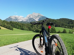
Asphalt
powered by TOURDATA
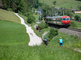
On the Kalkalpen National Park Bike Path, you constantly overview the majestic mountains of the national park region.
You start out in St. Pankraz and pedal through the Rettenbachtal valley to Windischgarsten, riding through Rossleithen along the way. In Windischgarsten, you can take a detour to Spital am Pyhrn, or you may prefer to select the challenging route via the state road over Hengst Pass to Unterlaussa.
Signs: R31 (part of the Upper Austria bike-path network)
Please note that you sometimes drive on goods roads with car and / or tractor traffic!
From May 1 to October 31, 2021, the bike shuttle bus runs between Steyr and Spital am Pyhrn / Hinterstoder on Saturdays, Sundays and public holidays. Reservation in advance is essential! You can find all information at www.radshuttle.at
Starting point: Nationalpark Raststation (petrol station) St. Pankraz
Destination: Where the path joins the Hintergebirgs bike path in Unterlaussa. Or variant 2: from St. Pankraz to Spital am Pyhrn (23km und 310hm).
further information:
- Board possible


Accessibility / arrival
Start at the national park rest stop (petrol station) in St. Pankraz.
- Suitable for groups
- Suitable for seniors
- Suitable for single travelers
- Suitable for friends
- Suitable for couples
- Spring
- Summer
- Autumn
Please get in touch for more information.
Bahnhofstraße 2
4580 Windischgarsten
Phone +43 7562 5266
Fax machine +43 7562 5266 - 10
E-Mail info@pyhrn-priel.net
Web www.urlaubsregion-pyhrn-priel.at
http://www.urlaubsregion-pyhrn-priel.at
")
")
")
")
")
")
")
")
")
")
")
")
")
")
")
")
")
")


")
")
")


")
")
")
")
")
Interactive elevation profile
Create PDF
Tour-Details
Path number: R31
Starting place: 4572 St. Pankraz
Destination: 8943 Unterlaussa
duration: 4h 28m
length: 40,0 km
Altitude difference (uphill): 690m
Altitude difference (downhill): 690m
Lowest point: 498m
Highest point: 991m
difficulty: medium
condition: medium
panoramic view: Great panorama
Paths covering:
Asphalt
powered by TOURDATA