

Mühlviertler SternGartl-Rundwanderweg - Teilstück Hellmonsödt


- All weather
- Suitable for families
Interactive elevation profile
Create PDF
Tour-Details
Starting place: 4202 Hellmonsödt
Destination: 4202 Hellmonsödt
duration: 1h 47m
length: 6,4 km
Altitude difference (uphill): 67m
Altitude difference (downhill): 237m
Lowest point: 638m
Highest point: 834m
difficulty: medium
condition: medium
panoramic view: Great panorama
Paths covering:
Asphalt, Gravel, Hiking trail
powered by TOURDATA
The tour joins the municipality of Sonnberg in the north and heads south via Hellmonsödt to the B126 to Stifterweg in Kirchschlag. Fourteen municipalities in the central Mühlviertel have joined forces to form the Mühlviertler SternGartl tourism region. A network of ecologically valuable areas is being developed between Afiesl and Ottenschlag, Reichenthal and Kirchschlag, which opens up the diversity of the local cultural landscape to hikers and at the same time contributes to the preservation of these ecological gems.
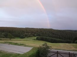
The SternGartl has a small-scale mosaic of natural beauty: The Müllenwiese fen on the watershed between the Mühl and Rodl regions, small springs, damp ditches and near-natural streams such as the Rodl and Steinerne Mühl bear witness to the abundance of water in the Mühlviertel. Moist and dry meadows, boulders, rocky bichln and stone walls, stone walls and heather meadows form a distinctive and varied landscape structure.
The SternGartl has a small-scale mosaic of natural beauty: The Müllenwiese fen on the watershed between the Mühl and Rodl regions, small springs, damp ditches and near-natural streams such as the Rodl and Steinerne Mühl bear witness to the abundance of water in the Mühlviertel. Moist and dry meadows, boulders, rocky bichln and stone walls, stone walls and heather meadows form a distinctive and varied landscape structure.
further information:
- Board possible
Details - hiking
- themed path
Parking
- Parking space: 50
- Parking area for disabled: 3
- Bus parking space: 3
- All weather
- Suitable for groups
- Suitable for schools
- Suitable for kids (10 - 14 Year)
- Suitable for single travelers
- Suitable for friends
- Suitable for couples
- Suitable for children
- Summer
- Autumn
Please get in touch for more information.
Marktplatz 1
4202 Hellmonsödt
Phone +43 7215 2255
E-Mail gemeinde@hellmonsoedt-zwettl.at
Web www.hellmonsoedt.ooe.gv.at/
Web www.sterngartl.at
http://www.hellmonsoedt.ooe.gv.at/
http://www.sterngartl.at
http://www.sterngartl.at
Interactive elevation profile
Create PDF
Tour-Details
Starting place: 4202 Hellmonsödt
Destination: 4202 Hellmonsödt
duration: 1h 47m
length: 6,4 km
Altitude difference (uphill): 67m
Altitude difference (downhill): 237m
Lowest point: 638m
Highest point: 834m
difficulty: medium
condition: medium
panoramic view: Great panorama
Paths covering:
Asphalt, Gravel, Hiking trail
powered by TOURDATA