Brockenbergweg

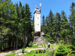
The trail leads through meadows and forests out of the village. On the ascent to the summit, the 'Ötscherblick' offers an opportunity to pause for a moment. From the viewing platform
on the Brockenberg (1058 m), the highest point in Liebenau, the view extends as far as the Alpine massif, Lower Austria and the Czech Republic, around 15 kilometres away as the crow flies. At its feet are the Koblberg (1044 m, the highest pass in Upper Austria), the Fuchsenlucka and the oldest former glassworks (around 1400), now the 'Glashütter' farm. A breathtaking view rewards you for the ascent before you return to the starting point.
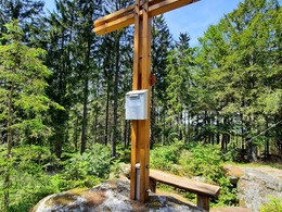
(The entrance fee for the observation tower is €1, payable at the coin-operated machine).
Paths covering:
further information:
- Flatly
- Possible accommodation
- Board possible
All year round
Exit Linz, continue on Mühlkreis motorway/A7/E55
exit Mühlkreis motorway/A7/E55, continue on Mühlkreis motorway/A7/E55
turn left onto Mauthausener-Bundesstraße/B123
follow direction: Wartberg Weitersfelden Mauthausen Gutau
turn left onto Mauthausener-Bundesstraße/B123
turn right onto Bahnhofstraße
enter Pregarten, continue on Bahnhofstraße
in Pregarten continue on Stadtplatz
exit Pregarten, continue on Gutauer Straße
turn half left onto Pregartsdorf
continue
turn half right
keep right onto Marktplatz
turn right onto Marktplatz
turn half right
turn left
left turn
half turn left onto Hauptstraße
half turn left
half turn right onto Langfirling
turn right onto Weitersfelden
half turn left onto Nadelbach
half turn right onto Liebenau
- All weather
- Spring
Please get in touch for more information.
4252 Liebenau
Phone +43 7953 8111
Fax machine +43 7953 8111 - 30
E-Mail r.ruttenstock@liebenau.at
Web www.liebenau.at


