Plochwaldrundweg
Path number: W1
Starting place: 4263 Windhaag bei Freistadt
Destination: 4263 Windhaag bei Freistadt
Markt 1
4263 Windhaag bei Freistadt
4263 Windhaag bei Freistadt

Market square - Windhaag sports ground - Waschenberg - Edhiasl Höhe - Edlbauer Felsen - Jankuskirche - Pachinger - sports ground
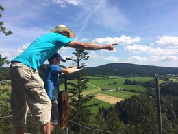
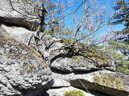
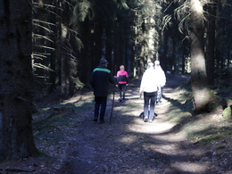
The trail starts at the market square and we walk towards the sports field, then we hike through meadows and fields through an ascending section of forest towards Plochwald to the Edlbauer stone rock. Here you can climb on the stone rock, which is secured by climbing aids, and enjoy a marvellous view to the west. After about a 10-minute walk, we pass the "Silbersee". A short detour (approx. 5 minutes) leads to the highest point of this hiking route and offers views as far as the Alps. We then head downhill through Predetschlag towards the Jankas church. Here you can climb up the stone rock again. There is an idyllic rest area with a bench at the foot of the rock formation. After a short ascent, the trail continues through the Waschenberg area to the Predetschlag goods road and in approx. 25 min. we reach the starting point again. Path number: W1
Starting place: 4263 Windhaag bei Freistadt
Destination: 4263 Windhaag bei Freistadt
duration: 3h 12m
length: 9,8 km
Altitude difference (uphill): 385m
Altitude difference (downhill): 368m
Lowest point: 722m
Highest point: 1.015m
difficulty: medium
condition: medium
panoramic view: Great panorama
Paths covering:
Asphalt, Hiking trail, Other
Starting point: Marketplace
Destination: Marketplace
further information:
- Possible accommodation
- Board possible
Accessibility / arrival
by car:
From Nuremberg via Passau-Schärding (Innkreisautobahn A8) and Linz (Mühlkreisautobahn A7).
From Munich and Vienna via the Westautobahn A1 to Linz;
From Linz (Mühlkreisautobahn A7) via Freistadt to Windhaag.
by train:
Via Linz main station to the final stop Freistadt or Summerau
- Suitable for groups
- Pets allowed
- Suitable for single travelers
- Suitable for families
- Spring
- Summer
- Autumn
Please get in touch for more information.
Markt 1
4263 Windhaag bei Freistadt
Phone +43 7943 6111
E-Mail tourismus@windhaag-freistadt.ooe.gv.at
Web www.windhaag-freistadt.ooe.gv.at
http://www.windhaag-freistadt.ooe.gv.at


