

Koglerberg-Weg


- Flatly
Interactive elevation profile
Create PDF
Tour-Details
Path number: 4
Starting place: 4372 St. Georgen am Walde
Destination: 4372 St. Georgen am Walde
duration: 4h 30m
length: 14,0 km
Altitude difference (uphill): 390m
Altitude difference (downhill): 390m
Lowest point: 702m
Highest point: 863m
difficulty: easy
condition: medium
panoramic view: Great panorama
Paths covering:
Asphalt, Hiking trail
powered by TOURDATA
From the pavilion via Jörgenberg - Dogerlholz to the ski lift valley station and through a beautiful forest path to Langenegg and down the valley via the main road to Hintermühle.
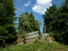
The route now climbs gently up to the summit of the Koglerberg at 876 metres.
On romantic forest and meadow paths you return through the village of Ottenschlag to Linden and St. Georgen.
The route now climbs gently up to the summit of the Koglerberg at 876 metres.
On romantic forest and meadow paths you return through the village of Ottenschlag to Linden and St. Georgen.
Most economical season
- Spring
- Autumn
Please get in touch for more information.
Markt 9
4372 St. Georgen am Walde
Phone +43 7954 3030 - 20
Fax machine +43 7954 3030 - 30
E-Mail tourismus@st.georgen.at
Web www.waldreich.at
Web www.oberoesterreich.at/st.georgen.w…
https://www.waldreich.at
https://www.oberoesterreich.at/st.georgen.walde
https://www.oberoesterreich.at/st.georgen.walde
Interactive elevation profile
Create PDF
Tour-Details
Path number: 4
Starting place: 4372 St. Georgen am Walde
Destination: 4372 St. Georgen am Walde
duration: 4h 30m
length: 14,0 km
Altitude difference (uphill): 390m
Altitude difference (downhill): 390m
Lowest point: 702m
Highest point: 863m
difficulty: easy
condition: medium
panoramic view: Great panorama
Paths covering:
Asphalt, Hiking trail
powered by TOURDATA