

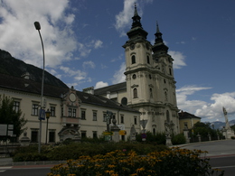
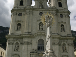
From the Spital Cathedral to the Dansbacher Chapel


Interactive elevation profile
Create PDF
Tour-Details
Path number: 616/617, 15
Starting place: 4582 Spital am Pyhrn
Destination: 4582 Spital am Pyhrn
duration: 1h 27m
length: 4,7 km
Altitude difference (uphill): 193m
Altitude difference (downhill): 21m
Lowest point: 640m
Highest point: 812m
difficulty: easy
condition: easy
panoramic view: Some Views
Paths covering:
Asphalt, Gravel
powered by TOURDATA
From the Spital Cathedral to the Dansbacher Chapel! From the baroque church , the "Pyhrn Cathedral" in Spital am Pyhrn walk through the alley to the main road B138, leading to trail nrs. 616/617, short walk along the pedestrian walk under the railway and follow the Oberwegerstraße to a wayside shrine and the turn off to the Hansl im Brandt farm.
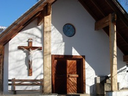
Here trail nr. 15 begins and leads through the courtyard of the farm slightly downhills over a small stream, follow along a hill through the forest and over a meadow to the Grössingergut farm. A short way on the tar road leads to the Helmhof farm and on along a private road through the forest slowly weiter auf einer Forststraße durch den Wald mit leichter Steigung zur Dansbacher Chapel.
From this point you reach the Freitgraben via a 500m long marked connection path, leading further to the dirt road leading to the Hengstpass.
Starting point: Collegiate Church Spital am Phyrn
Destination: Dansbacher Chapel in Oberweng
further information:
- Board possible
")

")
")
Accessibility / arrival
Directly to the collegiate church in the center of Spital am Phyrn.
Most economical season
- Spring
- Summer
- Autumn
Please get in touch for more information.

Stiftsplatz 1
4582 Spital am Pyhrn
Phone +43 7563 249
Fax machine +43 7563 249 - 20
E-Mail spital@pyhrn-priel.net
Web www.urlaubsregion-pyhrn-priel.at
http://www.urlaubsregion-pyhrn-priel.at
Interactive elevation profile
Create PDF
Tour-Details
Path number: 616/617, 15
Starting place: 4582 Spital am Pyhrn
Destination: 4582 Spital am Pyhrn
duration: 1h 27m
length: 4,7 km
Altitude difference (uphill): 193m
Altitude difference (downhill): 21m
Lowest point: 640m
Highest point: 812m
difficulty: easy
condition: easy
panoramic view: Some Views
Paths covering:
Asphalt, Gravel
powered by TOURDATA