

Rettenbach - Rießriegl - Spannriegl - Koppen


- Flatly
Interactive elevation profile
Create PDF
Tour-Details
Path number: 26
Starting place: 4575 Roßleithen
Destination: 4575 Roßleithen
duration: 2h 15m
length: 8,7 km
Altitude difference (uphill): 260m
Altitude difference (downhill): 260m
Lowest point: 583m
Highest point: 770m
difficulty: easy
condition: easy
panoramic view: Some Views
Paths covering:
Asphalt, Hiking trail
powered by TOURDATA
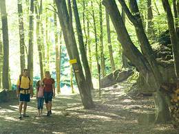
From trail nr 20 after the village Rading in Roßleithen turn right onto the municipal road (trail nr. 463 and 25, Nock) to the Redtenbach cross. Starting from the Vorderer Rettenbach parking lot, hike a short distance in the direction of the valley. At the fork in the road, turn left and cross the Rettenbach stream onto a forest road. However, you will soon leave this path and change to a forest road - past the Stadler farmhouse until you reach the junction with hiking trail 26 in the direction of Spannriegl, shortly before the Rießriegl farm.
The old Spannriegl farm - today owned by the Austrian Federal Forests - lies idyllically between gnarled fruit trees and a red deer feeding station. Through a short ditch you continue to the "Koppen" and from there on a road with little traffic back to the starting point (partly the Kalkalpen National Park cycle path R31 also runs here).
The old Spannriegl farm - today owned by the Austrian Federal Forests - lies idyllically between gnarled fruit trees and a red deer feeding station. Through a short ditch you continue to the "Koppen" and from there on a road with little traffic back to the starting point (partly the Kalkalpen National Park cycle path R31 also runs here).
Starting point: Parking Rettenbach in Roßleithen
Destination: Parking Rettenbach in Roßleithen
further information:
- Flatly
Please note the ban on entering 500m around the Spannriegl game feeding area from Nov 1 to Apr 30 from 3pm to 9am each day.
Accessibility / arrival
In Roßleithen you drive into the district Rading to the first parking lot Rettenbach.
Ideal for a journey by bike from the train station Rossleithen!
- Parking space: 20
Most economical season
- Spring
- Summer
- Autumn
Please get in touch for more information.

Bahnhofstraße 2
4580 Windischgarsten
Phone +43 7562 5266
Fax machine +43 7562 5266 - 10
E-Mail info@pyhrn-priel.net
Web www.urlaubsregion-pyhrn-priel.at
http://www.urlaubsregion-pyhrn-priel.at
Interactive elevation profile
Create PDF
Tour-Details
Path number: 26
Starting place: 4575 Roßleithen
Destination: 4575 Roßleithen
duration: 2h 15m
length: 8,7 km
Altitude difference (uphill): 260m
Altitude difference (downhill): 260m
Lowest point: 583m
Highest point: 770m
difficulty: easy
condition: easy
panoramic view: Some Views
Paths covering:
Asphalt, Hiking trail
powered by TOURDATA