Via the Teichl- and Rettenbach valleys to Windischgarsten


- Possible accommodation
Interactive elevation profile
Create PDF
Tour-Details
Starting place: 4572 St. Pankraz
Destination: 4580 Windischgarsten
duration: 4h 22m
length: 13,5 km
Altitude difference (uphill): 520m
Altitude difference (downhill): 452m
Lowest point: 497m
Highest point: 697m
difficulty: easy
condition: medium
panoramic view: Great panorama
Paths covering:
Gravel, Hiking trail
powered by TOURDATA
Via the Teichl- and Rettenbach valleys to Windischgarsten Starting point is the train station in St. Pankraz.
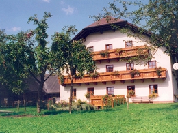
From here continue along to road to the village and further steep downhills to the Treichl stream. Stay on the right river bank and follow the red markings, first along a narrow road, then along a dirt road and finally along a climb leading to the beautifully situated Rohrauergut farm (original old farmhouse with mill and garner, 1 ¼ hrs). Now continue along the „Hühnersteig“ (chicken climb) into the Rettenbach valley.
From the village of Rettenbach you have various possibilities. Either via the Veichltal valley or via the Sonnwendkogel mountain to Windischgarsten.
The shortest path is to the train station of Roßleithen, leading past the Salmer chapel and a new settlement to the west of the „Gunst“.
Walking time: about 4 hrs.
Starting point: St. Pankraz railway location
Destination: Tourist Office Windischgarsten
further information:
- Possible accommodation
- Board possible
Accessibility / arrival
by car:
West motorway A1 - exit Voralpenkreuz on the A9 (Pyhrnautobahn) direction Graz - exit Roßleithen / Windischgarsten
by train:
Hauptbahnhof Linz - Windischgarsten
Graz - Selzthal - Windischgarsten
Most economical season
- Spring
- Summer
- Autumn
Please get in touch for more information.
Bahnhofstraße 2
4580 Windischgarsten
Phone +43 7562 5266
Fax machine +43 7562 5266 - 10
E-Mail info@pyhrn-priel.net
Web www.urlaubsregion-pyhrn-priel.at
http://www.urlaubsregion-pyhrn-priel.at
Interactive elevation profile
Create PDF
Tour-Details
Starting place: 4572 St. Pankraz
Destination: 4580 Windischgarsten
duration: 4h 22m
length: 13,5 km
Altitude difference (uphill): 520m
Altitude difference (downhill): 452m
Lowest point: 497m
Highest point: 697m
difficulty: easy
condition: medium
panoramic view: Great panorama
Paths covering:
Gravel, Hiking trail
powered by TOURDATA

