

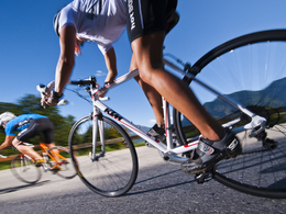
Rennradroute leicht


Interactive elevation profile
Create PDF
Tour-Details
Starting place: 4240 Freistadt
Destination: 4240 Freistadt
duration: 0h 39m
length: 7,6 km
Altitude difference (uphill): 169m
Altitude difference (downhill): 76m
Lowest point: 556m
Highest point: 682m
difficulty: easy
condition: medium
panoramic view: Individual Views
Paths covering:
Asphalt, Other
powered by TOURDATA
information: Rennradroute - Digital aufbereitet
Tour 1
Short loop around Freistadt. From km 8-12, the route climbs steadily, with the last 2 km of the ascent at approx. 8 %. Very nice view over the Mühlviertel!
Afterwards the route is slightly hilly towards Freistadt and the finish.
Short loop around Freistadt. From km 8-12, the route climbs steadily, with the last 2 km of the ascent at approx. 8 %. Very nice view over the Mühlviertel!
Afterwards the route is slightly hilly towards Freistadt and the finish.
")
- Suitable for seniors
- Suitable for single travelers
- Suitable for friends
- Spring
- Summer
- Autumn
Please get in touch for more information.
Hauptplatz 1
4240 Freistadt
Phone +43 664 8325756
E-Mail office@freistadt.city
Web freistadt.city
Web www.muehlviertel-urlaub.at/rad
https://freistadt.city
http://www.muehlviertel-urlaub.at/rad
http://www.muehlviertel-urlaub.at/rad
Interactive elevation profile
Create PDF
Tour-Details
Starting place: 4240 Freistadt
Destination: 4240 Freistadt
duration: 0h 39m
length: 7,6 km
Altitude difference (uphill): 169m
Altitude difference (downhill): 76m
Lowest point: 556m
Highest point: 682m
difficulty: easy
condition: medium
panoramic view: Individual Views
Paths covering:
Asphalt, Other
powered by TOURDATA