

Lake view round


- pets allowed
- All weather
- Suitable for families
- Flatly
Interactive elevation profile
Create PDF
Tour-Details
Starting place: 4863 Seewalchen am Attersee
Destination: 4863 Seewalchen am Attersee
duration: 1h 14m
length: 5,2 km
Altitude difference (uphill): 43m
Lowest point: 473m
Highest point: 516m
difficulty: easy
condition: easy
panoramic view: Great panorama
Paths covering:
Asphalt, Gravel, Hiking trail
powered by TOURDATA
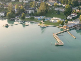
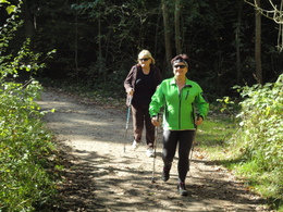
The starting point is the community in Seewalchen am Attersee and from there you continue on the school path (Zeitleistenweg) to Litzlberg, from where you have a beautiful lake view.
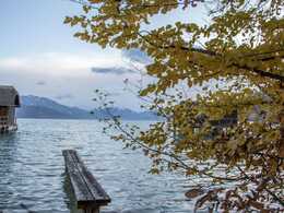
Along the school path (timeline path), through the forest (slight climb) to Gerlham. From here downhill in the direction of Litzlberg. Here a magnificent view of the Attersee and Kammer Castle opens up. Via Moos, Hainingerbach it goes back to the starting point in Seewalchen am Attersee.
Places of interest:
Parish church of St. Jabokus, view of Kammer Castle.
Refreshment stops:
Seewalchen am Attersee
Starting point: Municipal, church or Schulweg in Seewalchen am Attersee
Destination: Municipal, church or Schulweg in Seewalchen am Attersee
further information:
- Flatly
Accessible all year round | In winter is no winter service
")
")
")
")
Accessibility / arrival
by car:
A1-exit Seewalchen am Attersee further to the town hall square/municipality of Seewalchen.
A1-exit Mondsee further to Unterach and on the federal road to Seewalchen
From Bad Ischl from Weißenbachtal via Steinbach and Weyregg to Seewalchen
Starting point is the school path (Zeitleistenweg) in Seewalchen am Attersee
by train:
To Kammer/Schörfling am Attersee train station and on to Seewalchen.
By Atterseebahn to Attersee and further by bus to Seewalchen
Parking possibilities directly at the market place or the parish church in Seewalchen am Attersee.
- Parking space: 10
- All weather
- Suitable for groups
- Suitable for schools
- Suitable for kids (5 - 14 Year)
- Pets allowed
- Suitable for teenagers
- Suitable for seniors
- Suitable for single travelers
- Suitable for friends
- Suitable for couples
- Suitable for children
- Spring
- Summer
- Autumn
- Early winter
- Deep winter
Please get in touch for more information.
Rathausplatz 1
4863 Seewalchen am Attersee
Phone +43 7662 4491 - 0
E-Mail gemeinde@seewalchen.ooe.gv.at
Web www.seewalchen.eu/
Web attersee-attergau.salzkammergut.at
https://www.seewalchen.eu/
https://attersee-attergau.salzkammergut.at
https://attersee-attergau.salzkammergut.at
You can also visit us on
Visit us on Facebook Visit our videochannel on YouTube Wikipedia")
Interactive elevation profile
Create PDF
Tour-Details
Starting place: 4863 Seewalchen am Attersee
Destination: 4863 Seewalchen am Attersee
duration: 1h 14m
length: 5,2 km
Altitude difference (uphill): 43m
Lowest point: 473m
Highest point: 516m
difficulty: easy
condition: easy
panoramic view: Great panorama
Paths covering:
Asphalt, Gravel, Hiking trail
powered by TOURDATA