

Mühltalweg


- All weather
- culinary interesting
- culturally interesting
- Possible accommodation
Interactive elevation profile
Create PDF
Tour-Details
Path number: 58
Starting place: 4114 St. Martin im Mühlkreis
Destination: 4114 St. Martin im Mühlkreis
duration: 2h 30m
length: 9,9 km
Altitude difference (uphill): 397m
Altitude difference (downhill): 227m
Lowest point: 297m
Highest point: 480m
difficulty: easy
condition: easy
panoramic view: Dreamtour
Paths covering:
Asphalt, Hiking trail
powered by TOURDATA
Easy hike through the wooded valley of the Große Mühl
Not a circular route!
From Unternberg near Neufelden (Mühlkreisbahn railway stop) through the wooded and gorge-like valley of the Große
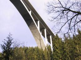
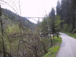
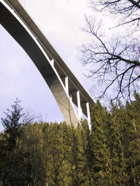
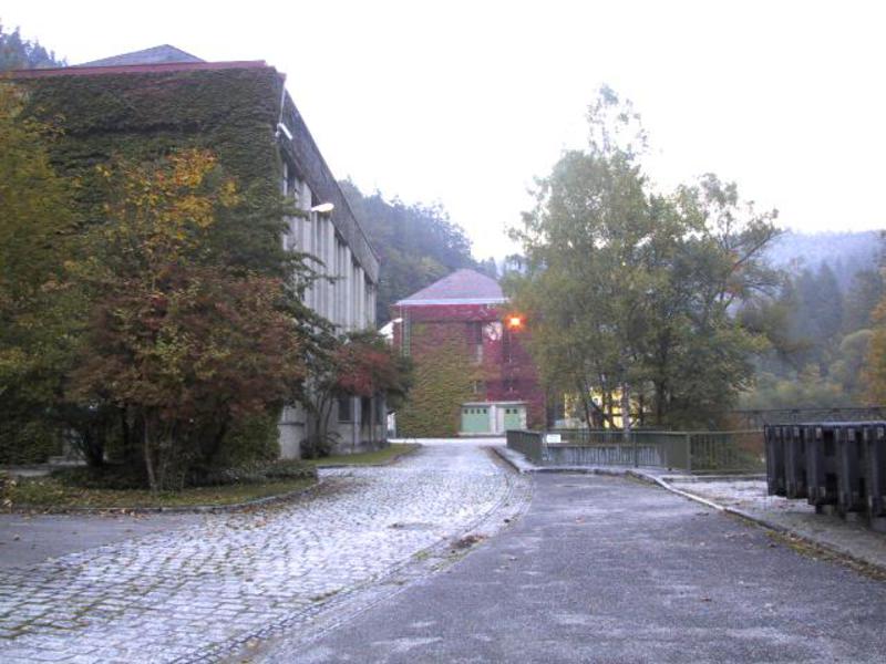
downstream through the wooded and gorge-like valley of the Große Mühl, past the pipe bridge (penstock of the Partenstein storage power station) and the "Schwarze Kuchl" (the rock overhang served as a shelter for timber floaters during the Scheiterschwemme from the Bohemian Forest into the Danube in the 18th and 19th centuries) to the Ebenmühle. Continue to the Partenstein storage power station (the first large hydroelectric power station in Austria to go into operation in 1924) before reaching Untermühl at the mouth of the Große Mühl into the Danube.
There is NO public transport available for the return journey!
Not a circular route!
From Unternberg near Neufelden (Mühlkreisbahn railway stop) through the wooded and gorge-like valley of the Große
downstream through the wooded and gorge-like valley of the Große Mühl, past the pipe bridge (penstock of the Partenstein storage power station) and the "Schwarze Kuchl" (the rock overhang served as a shelter for timber floaters during the Scheiterschwemme from the Bohemian Forest into the Danube in the 18th and 19th centuries) to the Ebenmühle. Continue to the Partenstein storage power station (the first large hydroelectric power station in Austria to go into operation in 1924) before reaching Untermühl at the mouth of the Große Mühl into the Danube.
There is NO public transport available for the return journey!
- All weather
- Suitable for groups
- Suitable for seniors
- Suitable for single travelers
- Suitable for friends
- Suitable for couples
- Spring
- Summer
- Autumn
Please get in touch for more information.
4114 St. Martin im Mühlkreis
Phone +43 7232 2105
E-Mail gemeindeamt@sankt-martin.at
Web www.tourismus.sankt-martin.at/somme…
http://www.tourismus.sankt-martin.at/sommer-wandern.php
Interactive elevation profile
Create PDF
Tour-Details
Path number: 58
Starting place: 4114 St. Martin im Mühlkreis
Destination: 4114 St. Martin im Mühlkreis
duration: 2h 30m
length: 9,9 km
Altitude difference (uphill): 397m
Altitude difference (downhill): 227m
Lowest point: 297m
Highest point: 480m
difficulty: easy
condition: easy
panoramic view: Dreamtour
Paths covering:
Asphalt, Hiking trail
powered by TOURDATA