SCHLÖSSERWEG | Bewegungs-Arena INNVIERTEL

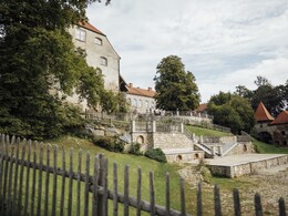
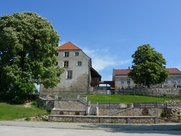
The Mininger Castle Trail leads along a route of 9 km through idyllic countryside, past eight stations worth seeing, where you can learn interesting facts from the information boards set up at each station. The starting point is at Frauenstein Castle, where the castle tavern Frauenstein is located in the architectural remains of the 1000-year-old, once feudal castle. Through the efforts of the Förderverein Lebendiges Frauenstein, the Salzstadl has been renovated and offers space for numerous cultural events in addition to the natural stage.
The tour continues to the rest area in Frauenstein and then to the center of Mining, where the Gothic and partly Baroque parish church with its imposing 56 m high onion tower and interesting epitaphs invites you to visit.
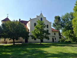
Via Gundhollinger- and Mamlinger Bahnhofstraße you reach Mamling Castle with its beautiful castle chapel, which was already documented in the 13th century and is now privately owned. Along the Römerradweg cycle path, the path leads past Sunszing Castle, also privately owned, with a mill building to the Augenbründl Chapel. At the Sunzinger oak tree, the Römerradweg cycle path rest area invites passers-by to take a break.
Passing the oak tree, which is more than 350 years old, you come back to Frauenstein Castle. On foot or by bike you can cross the power plant bridge and after about 2 km you reach two more stops: the church and castle Ering am Inn.
📌 refreshment stops in Mining
📌 Das ist los in Mining!
- Suitable for groups
- Suitable for pushchairs
- Suitable for families
- Suitable for friends
- Suitable for children
- Spring
- Summer
- Autumn
- Early winter
Suitable for wheelchairs: Not all of the legally stipulated ÖNORM are complied with. In principle, this object is suitable for wheelchairs and no assistance is necessary.
4962 Mining
Phone +43 7723 7055
E-Mail gemeinde@mining.ooe.gv.at
Web www.mining.ooe.gv.at


